La Cuesta geodata
La Cuesta (Castille and León) is a populated place; located in Spain in Europe/Madrid (GMT+2) time zone. With population of 5,000 people, there are 1308 cities with bigger population in this country. Compared to other cities in Spain, 50.5% of cities are located further ↓South; 59.1% of cities are located further →East and 94.3% of cities have lower elevation than La Cuesta. Note1
Administrative division(s):
- Level 1: Castille and León
- Level 2: Provincia de Segovia
- Level 3: Turégano


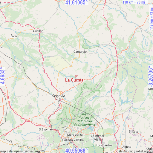
La Cuesta GPS coordinates[2]
41° 4' 58.08" North, 3° 57' 36.612" West
| Map corner | latitude | longitude |
|---|---|---|
| Upper-left | 41.61065°, | -4.6633° |
| Center: | 41.0828°, | -3.96017° |
| Lower-right: | 40.55068°, | -3.25705° |
| Map W x H: | 117.9×117.9 km | = 73.3×73.3mi |
| max Lat: | 43.74134° ⇑49.5% North |
| La Cuesta: | 41.0828° |
| min Lat: | ⇓50.5% South 27.64134° |
| min Long | La Cuesta | max Long |
| -18.00367° | -3.96017° | 4.2899° |
| W 40.9%⇐ | ⇒59.1% E |
Elevation
Elevation of La Cuesta is 1123 m = 3684 ft, and this is 525 m = 1722 ft above average elevation for this country.
| Max E: |
1682 m = 5518 ft | 5.7% |
| La Cuesta | 1123 m 3684 ft | |
| Avg. | 598 m = 1962 ft | |
Min E: |
0 m = 0 ft | 94.3% |
See also: Spain elevation on elevation.city.
Geographical zone
La Cuesta is located in North temperate zone (between Tropic of Cancer and the Arctic Circle). Distance of this Northern Tropic circle is 1962.1 km =1219.2 mi to South.| Distance of | km | miles | from La Cuesta |
|---|---|---|---|
| North Pole | 5439.1 | 3379.7 | to North |
| Arctic Circle | 2833.2 | 1760.5 | to North |
| Tropic Cancer | 1962.1 | 1219.2 | to South |
| Equator | 4568 | 2838.4 | to South |


Nearby cities:
15 places around La Cuesta: (largest is in red/bold)
• Adrada de Pirón
8.3 km =5.2 mi,  246°
246°
• Arahuetes
10.6 km =6.6 mi,  54°
54°
• Arevalillo de Cega
10.6 km =6.6 mi,  34°
34°
• Basardilla
8.3 km =5.2 mi,  221°
221°
• Brieva
9.5 km =5.9 mi,  235°
235°
• Caballar
4.3 km =2.7 mi,  355°
355°
• Collado Hermoso
6 km =3.7 mi,  144°
144°
• Cubillo
6.1 km =3.8 mi, 45°
• Muñoveros
10 km =6.2 mi,  4°
4°
• Pelayos del Arroyo
3.9 km =2.4 mi,  155°
155°
• Santo Domingo de Pirón
5.2 km =3.2 mi,  207°
207°
• Sotosalbos
5.5 km =3.4 mi, 163°
• Torre Val de San Pedro
7.5 km =4.7 mi,  96°
96°
• Torreiglesias
6.5 km =4 mi,  289°
289°
• Turégano
9 km =5.6 mi,  334°
334°
Sources, notices
• [Note1] Compared only with cities in Spain existing in our database
• [Src1] Map data: © OpenStreetMap contributors (CC-BY-SA)
• [Src2] Other city data from geonames.org with taken over terms of usage.
• [Src3] Geographical zone / Annual Mean Temperature by Robert A. Rohde @ Wikipedia
