Igúzquiza geodata
Igúzquiza (Navarre) is a seat of a third-order administrative division; located in Spain in Europe/Madrid (GMT+2) time zone. With population of 369 people, there are 4239 cities with bigger population in this country. Compared to other cities in Spain, 90.5% of cities are located further ↓South; 66.3% of cities are located further ←West and 60.9% of cities have higher elevation than Igúzquiza. Note1


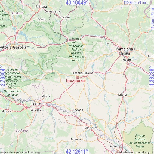
Igúzquiza GPS coordinates[2]
42° 38' 43.62" North, 2° 5' 7.836" West
| Map corner | latitude | longitude |
|---|---|---|
| Upper-left | 43.16049°, | -2.78864° |
| Center: | 42.64545°, | -2.08551° |
| Lower-right: | 42.12611°, | -1.38239° |
| Map W x H: | 115×115 km | = 71.5×71.5mi |
| max Lat: | 43.74134° ⇑9.5% North |
| Igúzquiza: | 42.64545° |
| min Lat: | ⇓90.5% South 27.64134° |
| min Long | Igúzquiza | max Long |
| -18.00367° | -2.08551° | 4.2899° |
| W 66.3%⇐ | ⇒33.7% E |
Elevation
Elevation of Igúzquiza is 515 m = 1690 ft, and this is 83 m = 272 ft below average elevation for this country.
| Max E: |
1682 m = 5518 ft | 60.9% |
| Avg. | 598 m = 1962 ft | |
| Igúzquiza | 515 m = 1690 ft | |
Min E: |
0 m = 0 ft | 39.1% |
See also: Spain elevation on elevation.city.
Geographical zone
Igúzquiza is located in North temperate zone (between Tropic of Cancer and the Arctic Circle). Distance of this Northern Tropic circle is 2135.8 km =1327.1 mi to South.| Distance of | km | miles | from Igúzquiza |
|---|---|---|---|
| North Pole | 5265.3 | 3271.7 | to North |
| Arctic Circle | 2659.4 | 1652.5 | to North |
| Tropic Cancer | 2135.8 | 1327.1 | to South |
| Equator | 4741.7 | 2946.4 | to South |


Nearby cities:
15 places around Igúzquiza: (largest is in red/bold)
• Abáigar
4.6 km =2.9 mi,  273°
273°
• Arellano
5.4 km =3.4 mi,  143°
143°
• Arróniz
6.4 km =4 mi,  185°
185°
• Ayegui
4 km =2.5 mi,  71°
71°
• Dicastillo
7.3 km =4.5 mi, 138°
• Estella-Lizarra
5.2 km =3.2 mi,  56°
56°
• Etayo
6.5 km =4 mi,  240°
240°
• Legaria
7.2 km =4.5 mi, 273°
• Metauten
5.1 km =3.2 mi,  313°
313°
• Morentin
6.9 km =4.3 mi,  121°
121°
• Murieta
5.8 km =3.6 mi,  281°
281°
• Oco
6.5 km =4 mi,  262°
262°
• Olejua
5.2 km =3.2 mi, 241°
• Villamayor de Monjardín
2.4 km =1.5 mi,  221°
221°
• Villatuerta
7.8 km =4.8 mi,  77°
77°
Sources, notices
• [Note1] Compared only with cities in Spain existing in our database
• [Src1] Map data: © OpenStreetMap contributors (CC-BY-SA)
• [Src2] Other city data from geonames.org with taken over terms of usage.
• [Src3] Geographical zone / Annual Mean Temperature by Robert A. Rohde @ Wikipedia
