Dicastillo geodata
Dicastillo (Navarre) is a seat of a third-order administrative division; located in Spain in Europe/Madrid (GMT+2) time zone. With population of 701 people, there are 3404 cities with bigger population in this country. Compared to other cities in Spain, 89.4% of cities are located further ↓South; 67.1% of cities are located further ←West and 59.6% of cities have higher elevation than Dicastillo. Note1


Dicastillo GPS coordinates[2]
42° 35' 47.292" North, 2° 1' 35.976" West
| Map corner | latitude | longitude |
|---|---|---|
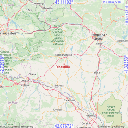
| Upper-left | 43.11192°, | -2.72978° |
| Center: | 42.59647°, | -2.02666° |
| Lower-right: | 42.07672°, | -1.32353° |
| Map W x H: | 115.1×115.1 km | = 71.5×71.5mi |
| max Lat: | 43.74134° ⇑10.6% North |
| Dicastillo: | 42.59647° |
| min Lat: | ⇓89.4% South 27.64134° |
| min Long | Dicastillo | max Long |
| -18.00367° | -2.02666° | 4.2899° |
| W 67.1%⇐ | ⇒32.9% E |
Elevation
Elevation of Dicastillo is 532 m = 1745 ft, and this is 66 m = 217 ft below average elevation for this country.
| Max E: |
1682 m = 5518 ft | 59.6% |
| Avg. | 598 m = 1962 ft | |
| Dicastillo | 532 m = 1745 ft | |
Min E: |
0 m = 0 ft | 40.4% |
See also: Spain elevation on elevation.city.
Geographical zone
Dicastillo is located in North temperate zone (between Tropic of Cancer and the Arctic Circle). Distance of this Northern Tropic circle is 2130.4 km =1323.8 mi to South.| Distance of | km | miles | from Dicastillo |
|---|---|---|---|
| North Pole | 5270.8 | 3275.1 | to North |
| Arctic Circle | 2664.9 | 1655.9 | to North |
| Tropic Cancer | 2130.4 | 1323.8 | to South |
| Equator | 4736.3 | 2943 | to South |


Nearby cities:
15 places around Dicastillo: (largest is in red/bold)
• Abáigar
11 km =6.8 mi,  301°
301°
• Allo
3.3 km =2.1 mi,  171°
171°
• Arellano
1.9 km =1.2 mi, 303°
• Arróniz
5.5 km =3.4 mi,  260°
260°
• Ayegui
6.8 km =4.2 mi,  351°
351°
• Estella-Lizarra
8.4 km =5.2 mi,  356°
356°
• Etayo
10.7 km =6.6 mi,  282°
282°
• Igúzquiza
7.3 km =4.5 mi,  318°
318°
• Metauten
12.3 km =7.6 mi, 316°
• Morentin
2.1 km =1.3 mi,  29°
29°
• Oco
12.2 km =7.6 mi,  292°
292°
• Olejua
9.9 km =6.2 mi, 287°
• Oteiza
6.5 km =4 mi,  67°
67°
• Villamayor de Monjardín
7.4 km =4.6 mi, 299°
• Villatuerta
7.6 km =4.7 mi,  21°
21°
Sources, notices
• [Note1] Compared only with cities in Spain existing in our database
• [Src1] Map data: © OpenStreetMap contributors (CC-BY-SA)
• [Src2] Other city data from geonames.org with taken over terms of usage.
• [Src3] Geographical zone / Annual Mean Temperature by Robert A. Rohde @ Wikipedia
