Fuertescusa geodata
Fuertescusa (Castille-La Mancha) is a seat of a third-order administrative division; located in Spain in Europe/Madrid (GMT+2) time zone. With population of 126 people, there are 5628 cities with bigger population in this country. Compared to other cities in Spain, 62.3% of cities are located further ↑North; 65.1% of cities are located further ←West and 87.4% of cities have lower elevation than Fuertescusa. Note1
Administrative division(s):
- Level 1: Castille-La Mancha
- Level 2: Provincia de Cuenca
- Level 3: Fuertescusa


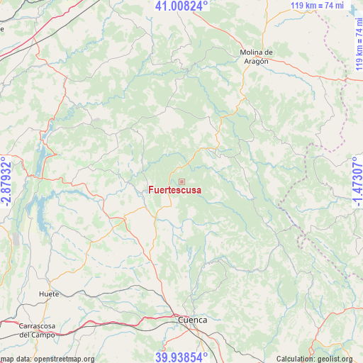
Fuertescusa GPS coordinates[2]
40° 28' 31.872" North, 2° 10' 34.32" West
| Map corner | latitude | longitude |
|---|---|---|
| Upper-left | 41.00824°, | -2.87932° |
| Center: | 40.47552°, | -2.1762° |
| Lower-right: | 39.93854°, | -1.47307° |
| Map W x H: | 118.9×118.9 km | = 73.9×73.9mi |
| max Lat: | 43.74134° ⇑62.3% North |
| Fuertescusa: | 40.47552° |
| min Lat: | ⇓37.7% South 27.64134° |
| min Long | Fuertescusa | max Long |
| -18.00367° | -2.1762° | 4.2899° |
| W 65.1%⇐ | ⇒34.9% E |
Elevation
Elevation of Fuertescusa is 987 m = 3238 ft, and this is 389 m = 1276 ft above average elevation for this country.
| Max E: |
1682 m = 5518 ft | 12.6% |
| Fuertescusa | 987 m 3238 ft | |
| Avg. | 598 m = 1962 ft | |
Min E: |
0 m = 0 ft | 87.4% |
See also: Spain elevation on elevation.city.
Geographical zone
Fuertescusa is located in North temperate zone (between Tropic of Cancer and the Arctic Circle). Distance of this Northern Tropic circle is 1894.5 km =1177.2 mi to South.| Distance of | km | miles | from Fuertescusa |
|---|---|---|---|
| North Pole | 5506.6 | 3421.6 | to North |
| Arctic Circle | 2900.7 | 1802.4 | to North |
| Tropic Cancer | 1894.5 | 1177.2 | to South |
| Equator | 4500.5 | 2796.5 | to South |


Nearby cities:
15 places around Fuertescusa: (largest is in red/bold)
• Albalate de las Nogueras
14.9 km =9.3 mi,  215°
215°
• Alcantud
15.5 km =9.6 mi,  301°
301°
• Arcos de la Sierra
15.3 km =9.5 mi,  159°
159°
• Beteta
13.7 km =8.5 mi,  38°
38°
• Carrascosa
12.9 km =8 mi,  4°
4°
• Castillejo-Sierra
11.6 km =7.2 mi, 164°
• Cañamares
6 km =3.7 mi,  244°
244°
• Cañizares
5 km =3.1 mi,  344°
344°
• Fresneda de la Sierra
9.8 km =6.1 mi, 163°
• La Frontera
8.9 km =5.5 mi,  202°
202°
• Lagunaseca
14.6 km =9.1 mi,  65°
65°
• Masegosa
15 km =9.3 mi,  58°
58°
• Priego
12 km =7.5 mi,  256°
256°
• Santa María del Val
11.9 km =7.4 mi, 74°
• Villaconejos de Trabaque
14.7 km =9.1 mi, 235°
Sources, notices
• [Note1] Compared only with cities in Spain existing in our database
• [Src1] Map data: © OpenStreetMap contributors (CC-BY-SA)
• [Src2] Other city data from geonames.org with taken over terms of usage.
• [Src3] Geographical zone / Annual Mean Temperature by Robert A. Rohde @ Wikipedia
