La Frontera geodata
La Frontera (Castille-La Mancha) is a seat of a third-order administrative division; located in Spain in Europe/Madrid (GMT+2) time zone. With population of 204 people, there are 5015 cities with bigger population in this country. Compared to other cities in Spain, 64% of cities are located further ↑North; 64.5% of cities are located further ←West and 86.8% of cities have lower elevation than La Frontera. Note1
Administrative division(s):
- Level 1: Castille-La Mancha
- Level 2: Provincia de Cuenca
- Level 3: La Frontera


La Frontera GPS coordinates[2]
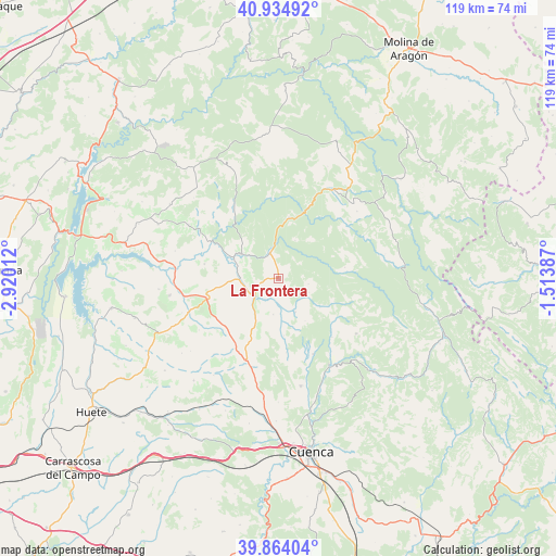
40° 24' 5.796" North, 2° 13' 1.164" West
| Map corner | latitude | longitude |
|---|---|---|
| Upper-left | 40.93492°, | -2.92012° |
| Center: | 40.40161°, | -2.21699° |
| Lower-right: | 39.86404°, | -1.51387° |
| Map W x H: | 119.1×119.1 km | = 74×74mi |
| max Lat: | 43.74134° ⇑64% North |
| La Frontera: | 40.40161° |
| min Lat: | ⇓36% South 27.64134° |
| min Long | La Frontera | max Long |
| -18.00367° | -2.21699° | 4.2899° |
| W 64.5%⇐ | ⇒35.5% E |
Elevation
Elevation of La Frontera is 977 m = 3205 ft, and this is 379 m = 1243 ft above average elevation for this country.
| Max E: |
1682 m = 5518 ft | 13.2% |
| La Frontera | 977 m 3205 ft | |
| Avg. | 598 m = 1962 ft | |
Min E: |
0 m = 0 ft | 86.8% |
See also: Spain elevation on elevation.city.
Geographical zone
La Frontera is located in North temperate zone (between Tropic of Cancer and the Arctic Circle). Distance of this Northern Tropic circle is 1886.3 km =1172.1 mi to South.| Distance of | km | miles | from La Frontera |
|---|---|---|---|
| North Pole | 5514.8 | 3426.7 | to North |
| Arctic Circle | 2908.9 | 1807.5 | to North |
| Tropic Cancer | 1886.3 | 1172.1 | to South |
| Equator | 4492.2 | 2791.3 | to South |


Nearby cities:
15 places around La Frontera: (largest is in red/bold)
• Albalate de las Nogueras
6.4 km =4 mi,  232°
232°
• Arcos de la Sierra
10.7 km =6.6 mi,  124°
124°
• Arrancacepas
16.3 km =10.1 mi, 227°
• Castillejo-Sierra
7.1 km =4.4 mi,  114°
114°
• Cañamares
5.9 km =3.7 mi,  340°
340°
• Cañaveras
15.9 km =9.9 mi,  253°
253°
• Cañizares
13.2 km =8.2 mi,  9°
9°
• Fresneda de la Sierra
6.4 km =4 mi,  100°
100°
• Fuertescusa
8.9 km =5.5 mi,  22°
22°
• Portilla
16.9 km =10.5 mi,  137°
137°
• Priego
9.8 km =6.1 mi,  302°
302°
• San Pedro Palmiches
16.3 km =10.1 mi,  280°
280°
• Torralba
12.5 km =7.8 mi,  207°
207°
• Villaconejos de Trabaque
8.7 km =5.4 mi,  269°
269°
• Zarzuela
18.3 km =11.4 mi,  150°
150°
Sources, notices
• [Note1] Compared only with cities in Spain existing in our database
• [Src1] Map data: © OpenStreetMap contributors (CC-BY-SA)
• [Src2] Other city data from geonames.org with taken over terms of usage.
• [Src3] Geographical zone / Annual Mean Temperature by Robert A. Rohde @ Wikipedia
