Cañizares geodata
Cañizares (Castille-La Mancha) is a seat of a third-order administrative division; located in Spain in Europe/Madrid (GMT+2) time zone. With population of 595 people, there are 3625 cities with bigger population in this country. Compared to other cities in Spain, 61.4% of cities are located further ↑North; 64.9% of cities are located further ←West and 91.6% of cities have lower elevation than Cañizares. Note1
Administrative division(s):
- Level 1: Castille-La Mancha
- Level 2: Provincia de Cuenca
- Level 3: Cañizares


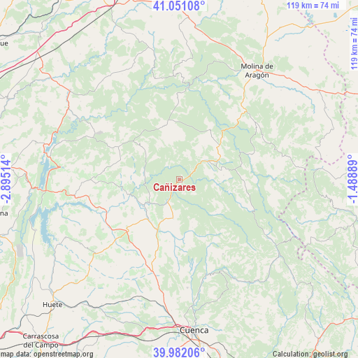
Cañizares GPS coordinates[2]
40° 31' 7.32" North, 2° 11' 31.236" West
| Map corner | latitude | longitude |
|---|---|---|
| Upper-left | 41.05108°, | -2.89514° |
| Center: | 40.5187°, | -2.19201° |
| Lower-right: | 39.98206°, | -1.48889° |
| Map W x H: | 118.9×118.9 km | = 73.9×73.9mi |
| max Lat: | 43.74134° ⇑61.4% North |
| Cañizares: | 40.5187° |
| min Lat: | ⇓38.6% South 27.64134° |
| min Long | Cañizares | max Long |
| -18.00367° | -2.19201° | 4.2899° |
| W 64.9%⇐ | ⇒35.1% E |
Elevation
Elevation of Cañizares is 1061 m = 3481 ft, and this is 463 m = 1519 ft above average elevation for this country.
| Max E: |
1682 m = 5518 ft | 8.4% |
| Cañizares | 1061 m 3481 ft | |
| Avg. | 598 m = 1962 ft | |
Min E: |
0 m = 0 ft | 91.6% |
See also: Spain elevation on elevation.city.
Geographical zone
Cañizares is located in North temperate zone (between Tropic of Cancer and the Arctic Circle). Distance of this Northern Tropic circle is 1899.3 km =1180.2 mi to South.| Distance of | km | miles | from Cañizares |
|---|---|---|---|
| North Pole | 5501.8 | 3418.7 | to North |
| Arctic Circle | 2895.9 | 1799.4 | to North |
| Tropic Cancer | 1899.3 | 1180.2 | to South |
| Equator | 4505.3 | 2799.5 | to South |


Nearby cities:
15 places around Cañizares: (largest is in red/bold)
• Alcantud
12.3 km =7.6 mi,  285°
285°
• Arandilla del Arroyo
16.2 km =10.1 mi,  266°
266°
• Beteta
11.5 km =7.1 mi,  58°
58°
• Carrascosa
8.4 km =5.2 mi,  16°
16°
• Castillejo-Sierra
16.6 km =10.3 mi,  164°
164°
• Cañamares
8.4 km =5.2 mi,  208°
208°
• Cueva del Hierro
15 km =9.3 mi, 61°
• Fresneda de la Sierra
14.8 km =9.2 mi, 163°
• Fuertescusa
5 km =3.1 mi, 164°
• La Frontera
13.2 km =8.2 mi,  189°
189°
• Lagunaseca
14.6 km =9.1 mi,  84°
84°
• Masegosa
14.4 km =8.9 mi, 77°
• Priego
12.9 km =8 mi,  233°
233°
• Santa María del Val
12.9 km =8 mi,  97°
97°
• Valsalobre
13.8 km =8.6 mi,  37°
37°
Sources, notices
• [Note1] Compared only with cities in Spain existing in our database
• [Src1] Map data: © OpenStreetMap contributors (CC-BY-SA)
• [Src2] Other city data from geonames.org with taken over terms of usage.
• [Src3] Geographical zone / Annual Mean Temperature by Robert A. Rohde @ Wikipedia
