Fuentepinilla geodata
Fuentepinilla (Castille and León) is a seat of a third-order administrative division; located in Spain in Europe/Madrid (GMT+2) time zone. With population of 143 people, there are 5475 cities with bigger population in this country. Compared to other cities in Spain, 62.6% of cities are located further ↓South; 57.9% of cities are located further ←West and 83.9% of cities have lower elevation than Fuentepinilla. Note1
Administrative division(s):
- Level 1: Castille and León
- Level 2: Provincia de Soria
- Level 3: Fuentepinilla


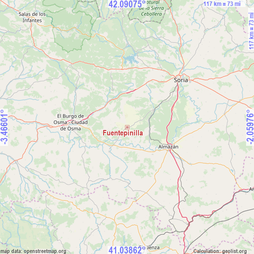
Fuentepinilla GPS coordinates[2]
41° 34' 0.588" North, 2° 45' 46.368" West
| Map corner | latitude | longitude |
|---|---|---|
| Upper-left | 42.09075°, | -3.46601° |
| Center: | 41.56683°, | -2.76288° |
| Lower-right: | 41.03862°, | -2.05976° |
| Map W x H: | 117×117 km | = 72.7×72.7mi |
| max Lat: | 43.74134° ⇑37.4% North |
| Fuentepinilla: | 41.56683° |
| min Lat: | ⇓62.6% South 27.64134° |
| min Long | Fuentepinilla | max Long |
| -18.00367° | -2.76288° | 4.2899° |
| W 57.9%⇐ | ⇒42.1% E |
Elevation
Elevation of Fuentepinilla is 940 m = 3084 ft, and this is 342 m = 1122 ft above average elevation for this country.
| Max E: |
1682 m = 5518 ft | 16.1% |
| Fuentepinilla | 940 m 3084 ft | |
| Avg. | 598 m = 1962 ft | |
Min E: |
0 m = 0 ft | 83.9% |
See also: Spain elevation on elevation.city.
Geographical zone
Fuentepinilla is located in North temperate zone (between Tropic of Cancer and the Arctic Circle). Distance of this Northern Tropic circle is 2015.9 km =1252.6 mi to South.| Distance of | km | miles | from Fuentepinilla |
|---|---|---|---|
| North Pole | 5385.3 | 3346.3 | to North |
| Arctic Circle | 2779.4 | 1727 | to North |
| Tropic Cancer | 2015.9 | 1252.6 | to South |
| Equator | 4621.8 | 2871.9 | to South |


Nearby cities:
15 places around Fuentepinilla: (largest is in red/bold)
• Barca
17.1 km =10.6 mi,  136°
136°
• Bayubas de Abajo
11.9 km =7.4 mi,  248°
248°
• Bayubas de Arriba
10.4 km =6.5 mi,  264°
264°
• Berlanga de Duero
13.9 km =8.6 mi,  216°
216°
• Blacos
15 km =9.3 mi,  327°
327°
• Calatañazor
15.4 km =9.6 mi,  342°
342°
• Centenera de Andaluz
7.6 km =4.7 mi,  150°
150°
• Matamala de Almazán
12.2 km =7.6 mi,  123°
123°
• Quintana Redonda
14.7 km =9.1 mi,  56°
56°
• Tajueco
7.9 km =4.9 mi,  244°
244°
• Tardelcuende
10.3 km =6.4 mi,  72°
72°
• Torreblacos
14.9 km =9.3 mi,  319°
319°
• Valdenebro
16.8 km =10.4 mi,  271°
271°
• Valderrodilla
3.8 km =2.4 mi, 264°
• Velamazán
14.1 km =8.8 mi,  158°
158°
Sources, notices
• [Note1] Compared only with cities in Spain existing in our database
• [Src1] Map data: © OpenStreetMap contributors (CC-BY-SA)
• [Src2] Other city data from geonames.org with taken over terms of usage.
• [Src3] Geographical zone / Annual Mean Temperature by Robert A. Rohde @ Wikipedia
