Fuentepelayo geodata
Fuentepelayo (Castille and León) is a seat of a third-order administrative division; located in Spain in Europe/Madrid (GMT+2) time zone. With population of 979 people, there are 2982 cities with bigger population in this country. Compared to other cities in Spain, 53.8% of cities are located further ↓South; 62.2% of cities are located further →East and 76.8% of cities have lower elevation than Fuentepelayo. Note1
Administrative division(s):
- Level 1: Castille and León
- Level 2: Provincia de Segovia
- Level 3: Fuentepelayo


Fuentepelayo GPS coordinates[2]
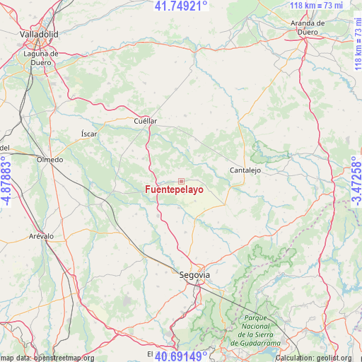
41° 13' 20.964" North, 4° 10' 32.52" West
| Map corner | latitude | longitude |
|---|---|---|
| Upper-left | 41.74921°, | -4.87883° |
| Center: | 41.22249°, | -4.1757° |
| Lower-right: | 40.69149°, | -3.47258° |
| Map W x H: | 117.6×117.6 km | = 73.1×73.1mi |
| max Lat: | 43.74134° ⇑46.2% North |
| Fuentepelayo: | 41.22249° |
| min Lat: | ⇓53.8% South 27.64134° |
| min Long | Fuentepelayo | max Long |
| -18.00367° | -4.1757° | 4.2899° |
| W 37.8%⇐ | ⇒62.2% E |
Elevation
Elevation of Fuentepelayo is 869 m = 2851 ft, and this is 271 m = 889 ft above average elevation for this country.
| Max E: |
1682 m = 5518 ft | 23.2% |
| Fuentepelayo | 869 m 2851 ft | |
| Avg. | 598 m = 1962 ft | |
Min E: |
0 m = 0 ft | 76.8% |
See also: Spain elevation on elevation.city.
Geographical zone
Fuentepelayo is located in North temperate zone (between Tropic of Cancer and the Arctic Circle). Distance of this Northern Tropic circle is 1977.6 km =1228.8 mi to South.| Distance of | km | miles | from Fuentepelayo |
|---|---|---|---|
| North Pole | 5423.6 | 3370.1 | to North |
| Arctic Circle | 2817.7 | 1750.8 | to North |
| Tropic Cancer | 1977.6 | 1228.8 | to South |
| Equator | 4583.5 | 2848.1 | to South |


Nearby cities:
15 places around Fuentepelayo: (largest is in red/bold)
• Aguilafuente
5.4 km =3.4 mi,  85°
85°
• Aldea Real
4.2 km =2.6 mi,  168°
168°
• Carbonero el Mayor
13.4 km =8.3 mi,  213°
213°
• Escalona del Prado
7.6 km =4.7 mi,  144°
144°
• Escarabajosa de Cabezas
13.2 km =8.2 mi,  186°
186°
• Gómezserracín
14.6 km =9.1 mi,  300°
300°
• Hontalbilla
14.4 km =8.9 mi,  18°
18°
• Lastras de Cuéllar
10.2 km =6.3 mi,  34°
34°
• Mozoncillo
8.6 km =5.3 mi, 186°
• Navalmanzano
6.8 km =4.2 mi,  263°
263°
• Pinarejos
10.7 km =6.6 mi,  292°
292°
• Pinarnegrillo
4.5 km =2.8 mi,  219°
219°
• Sauquillo de Cabezas
9.5 km =5.9 mi,  109°
109°
• Tabanera la Luenga
15 km =9.3 mi,  200°
200°
• Zarzuela del Pinar
4.3 km =2.7 mi,  349°
349°
Sources, notices
• [Note1] Compared only with cities in Spain existing in our database
• [Src1] Map data: © OpenStreetMap contributors (CC-BY-SA)
• [Src2] Other city data from geonames.org with taken over terms of usage.
• [Src3] Geographical zone / Annual Mean Temperature by Robert A. Rohde @ Wikipedia
