Pinarejos geodata
Pinarejos (Castille and León) is a seat of a third-order administrative division; located in Spain in Europe/Madrid (GMT+2) time zone. With population of 167 people, there are 5288 cities with bigger population in this country. Compared to other cities in Spain, 54.5% of cities are located further ↓South; 63.7% of cities are located further →East and 71.2% of cities have lower elevation than Pinarejos. Note1
Administrative division(s):
- Level 1: Castille and León
- Level 2: Provincia de Segovia
- Level 3: Pinarejos


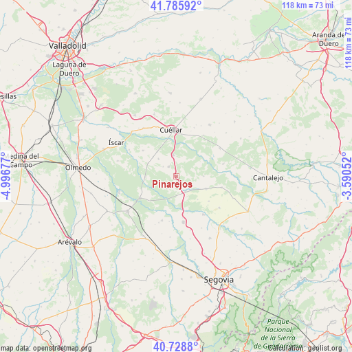
Pinarejos GPS coordinates[2]
41° 15' 34.2" North, 4° 17' 37.104" West
| Map corner | latitude | longitude |
|---|---|---|
| Upper-left | 41.78592°, | -4.99677° |
| Center: | 41.2595°, | -4.29364° |
| Lower-right: | 40.7288°, | -3.59052° |
| Map W x H: | 117.5×117.5 km | = 73×73mi |
| max Lat: | 43.74134° ⇑45.5% North |
| Pinarejos: | 41.2595° |
| min Lat: | ⇓54.5% South 27.64134° |
| min Long | Pinarejos | max Long |
| -18.00367° | -4.29364° | 4.2899° |
| W 36.3%⇐ | ⇒63.7% E |
Elevation
Elevation of Pinarejos is 822 m = 2697 ft, and this is 224 m = 735 ft above average elevation for this country.
| Max E: |
1682 m = 5518 ft | 28.8% |
| Pinarejos | 822 m 2697 ft | |
| Avg. | 598 m = 1962 ft | |
Min E: |
0 m = 0 ft | 71.2% |
See also: Spain elevation on elevation.city.
Geographical zone
Pinarejos is located in North temperate zone (between Tropic of Cancer and the Arctic Circle). Distance of this Northern Tropic circle is 1981.7 km =1231.4 mi to South.| Distance of | km | miles | from Pinarejos |
|---|---|---|---|
| North Pole | 5419.4 | 3367.5 | to North |
| Arctic Circle | 2813.5 | 1748.2 | to North |
| Tropic Cancer | 1981.7 | 1231.4 | to South |
| Equator | 4587.6 | 2850.6 | to South |


Nearby cities:
15 places around Pinarejos: (largest is in red/bold)
• Aguilafuente
15.6 km =9.7 mi,  103°
103°
• Aldea Real
13.5 km =8.4 mi,  127°
127°
• Bernardos
15.4 km =9.6 mi,  198°
198°
• Carbonero el Mayor
15.4 km =9.6 mi,  170°
170°
• Chañe
14.2 km =8.8 mi,  308°
308°
• Fresneda de Cuéllar
14.6 km =9.1 mi,  296°
296°
• Fuentepelayo
10.7 km =6.6 mi,  112°
112°
• Gómezserracín
4.3 km =2.7 mi,  320°
320°
• Mozoncillo
15.5 km =9.6 mi,  145°
145°
• Navalmanzano
5.8 km =3.6 mi, 147°
• Navas de Oro
13.9 km =8.6 mi,  239°
239°
• Pinarnegrillo
10.4 km =6.5 mi,  137°
137°
• Samboal
10.3 km =6.4 mi,  268°
268°
• Sanchonuño
7.2 km =4.5 mi,  352°
352°
• Zarzuela del Pinar
9.1 km =5.7 mi,  89°
89°
Sources, notices
• [Note1] Compared only with cities in Spain existing in our database
• [Src1] Map data: © OpenStreetMap contributors (CC-BY-SA)
• [Src2] Other city data from geonames.org with taken over terms of usage.
• [Src3] Geographical zone / Annual Mean Temperature by Robert A. Rohde @ Wikipedia
