Aldea Real geodata
Aldea Real (Castille and León) is a seat of a third-order administrative division; located in Spain in Europe/Madrid (GMT+2) time zone. With population of 385 people, there are 4183 cities with bigger population in this country. Compared to other cities in Spain, 52.8% of cities are located further ↓South; 62.1% of cities are located further →East and 78.4% of cities have lower elevation than Aldea Real. Note1
Administrative division(s):
- Level 1: Castille and León
- Level 2: Provincia de Segovia
- Level 3: Aldea Real


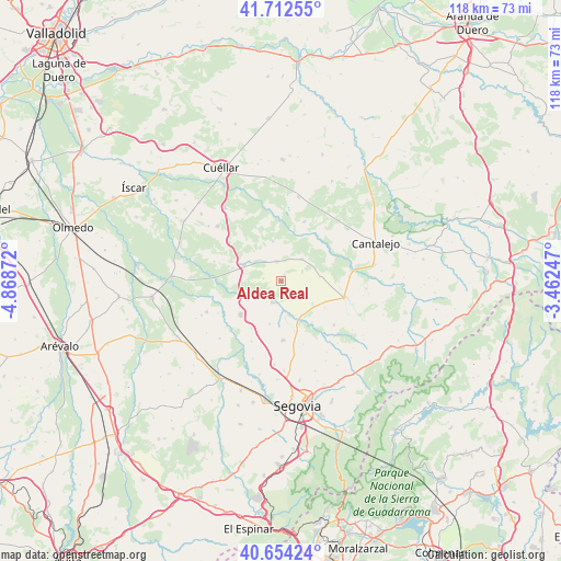
Aldea Real GPS coordinates[2]
41° 11' 7.908" North, 4° 9' 56.124" West
| Map corner | latitude | longitude |
|---|---|---|
| Upper-left | 41.71255°, | -4.86872° |
| Center: | 41.18553°, | -4.16559° |
| Lower-right: | 40.65424°, | -3.46247° |
| Map W x H: | 117.7×117.7 km | = 73.1×73.1mi |
| max Lat: | 43.74134° ⇑47.2% North |
| Aldea Real: | 41.18553° |
| min Lat: | ⇓52.8% South 27.64134° |
| min Long | Aldea Real | max Long |
| -18.00367° | -4.16559° | 4.2899° |
| W 37.9%⇐ | ⇒62.1% E |
Elevation
Elevation of Aldea Real is 883 m = 2897 ft, and this is 285 m = 935 ft above average elevation for this country.
| Max E: |
1682 m = 5518 ft | 21.6% |
| Aldea Real | 883 m 2897 ft | |
| Avg. | 598 m = 1962 ft | |
Min E: |
0 m = 0 ft | 78.4% |
See also: Spain elevation on elevation.city.
Geographical zone
Aldea Real is located in North temperate zone (between Tropic of Cancer and the Arctic Circle). Distance of this Northern Tropic circle is 1973.5 km =1226.3 mi to South.| Distance of | km | miles | from Aldea Real |
|---|---|---|---|
| North Pole | 5427.7 | 3372.6 | to North |
| Arctic Circle | 2821.8 | 1753.4 | to North |
| Tropic Cancer | 1973.5 | 1226.3 | to South |
| Equator | 4579.4 | 2845.5 | to South |


Nearby cities:
15 places around Aldea Real: (largest is in red/bold)
• Aguilafuente
6.4 km =4 mi,  44°
44°
• Cantimpalos
12.4 km =7.7 mi,  177°
177°
• Carbonero el Mayor
10.9 km =6.8 mi,  229°
229°
• Escalona del Prado
4.1 km =2.5 mi,  120°
120°
• Escarabajosa de Cabezas
9.3 km =5.8 mi,  194°
194°
• Escobar de Polendos
10.9 km =6.8 mi,  164°
164°
• Fuentepelayo
4.2 km =2.6 mi,  348°
348°
• Lastras de Cuéllar
13.4 km =8.3 mi,  21°
21°
• Mozoncillo
4.8 km =3 mi,  202°
202°
• Navalmanzano
8.3 km =5.2 mi,  294°
294°
• Pinarejos
13.5 km =8.4 mi,  307°
307°
• Pinarnegrillo
3.7 km =2.3 mi,  279°
279°
• Sauquillo de Cabezas
8.2 km =5.1 mi,  83°
83°
• Tabanera la Luenga
11.7 km =7.3 mi,  211°
211°
• Zarzuela del Pinar
8.5 km =5.3 mi, 349°
Sources, notices
• [Note1] Compared only with cities in Spain existing in our database
• [Src1] Map data: © OpenStreetMap contributors (CC-BY-SA)
• [Src2] Other city data from geonames.org with taken over terms of usage.
• [Src3] Geographical zone / Annual Mean Temperature by Robert A. Rohde @ Wikipedia
