Gómezserracín geodata
Gómezserracín (Castille and León) is a populated place; located in Spain in Europe/Madrid (GMT+2) time zone. With population of 727 people, there are 3353 cities with bigger population in this country. Compared to other cities in Spain, 55.2% of cities are located further ↓South; 64.1% of cities are located further →East and 68.8% of cities have lower elevation than Gómezserracín. Note1
Administrative division(s):
- Level 1: Castille and León
- Level 2: Provincia de Segovia
- Level 3: Gomezserracín


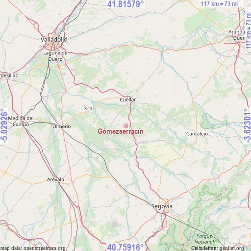
Gómezserracín GPS coordinates[2]
41° 17' 22.596" North, 4° 19' 34.068" West
| Map corner | latitude | longitude |
|---|---|---|
| Upper-left | 41.81579°, | -5.02926° |
| Center: | 41.28961°, | -4.32613° |
| Lower-right: | 40.75916°, | -3.62301° |
| Map W x H: | 117.5×117.5 km | = 73×73mi |
| max Lat: | 43.74134° ⇑44.8% North |
| Gómezserracín: | 41.28961° |
| min Lat: | ⇓55.2% South 27.64134° |
| min Long | Gómezserracín | max Long |
| -18.00367° | -4.32613° | 4.2899° |
| W 35.9%⇐ | ⇒64.1% E |
Elevation
Elevation of Gómezserracín is 804 m = 2638 ft, and this is 206 m = 676 ft above average elevation for this country.
| Max E: |
1682 m = 5518 ft | 31.2% |
| Gómezserracín | 804 m 2638 ft | |
| Avg. | 598 m = 1962 ft | |
Min E: |
0 m = 0 ft | 68.8% |
See also: Spain elevation on elevation.city.
Geographical zone
Gómezserracín is located in North temperate zone (between Tropic of Cancer and the Arctic Circle). Distance of this Northern Tropic circle is 1985.1 km =1233.5 mi to South.| Distance of | km | miles | from Gómezserracín |
|---|---|---|---|
| North Pole | 5416.1 | 3365.4 | to North |
| Arctic Circle | 2810.2 | 1746.2 | to North |
| Tropic Cancer | 1985.1 | 1233.5 | to South |
| Equator | 4591 | 2852.7 | to South |


Nearby cities:
15 places around Gómezserracín: (largest is in red/bold)
• Chañe
10.1 km =6.3 mi,  302°
302°
• Cuéllar
12.5 km =7.8 mi,  4°
4°
• Fresneda de Cuéllar
10.8 km =6.7 mi,  287°
287°
• Frumales
15.6 km =9.7 mi,  48°
48°
• Fuentepelayo
14.6 km =9.1 mi,  120°
120°
• Navalmanzano
10.1 km =6.3 mi,  144°
144°
• Navas de Oro
13.9 km =8.6 mi,  221°
221°
• Pinarejos
4.3 km =2.7 mi, 140°
• Pinarnegrillo
14.7 km =9.1 mi, 138°
• Remondo
14.4 km =8.9 mi, 293°
• Samboal
8.4 km =5.2 mi,  244°
244°
• San Cristóbal de Cuéllar
14.5 km =9 mi,  333°
333°
• Sanchonuño
4.1 km =2.5 mi,  24°
24°
• Vallelado
15.3 km =9.5 mi, 326°
• Zarzuela del Pinar
12.3 km =7.6 mi,  105°
105°
Sources, notices
• [Note1] Compared only with cities in Spain existing in our database
• [Src1] Map data: © OpenStreetMap contributors (CC-BY-SA)
• [Src2] Other city data from geonames.org with taken over terms of usage.
• [Src3] Geographical zone / Annual Mean Temperature by Robert A. Rohde @ Wikipedia
