Adrados geodata
Adrados (Castille and León) is a seat of a third-order administrative division; located in Spain in Europe/Madrid (GMT+2) time zone. With population of 176 people, there are 5212 cities with bigger population in this country. Compared to other cities in Spain, 56.7% of cities are located further ↓South; 61.4% of cities are located further →East and 78.5% of cities have lower elevation than Adrados. Note1
Administrative division(s):
- Level 1: Castille and León
- Level 2: Provincia de Segovia
- Level 3: Adrados


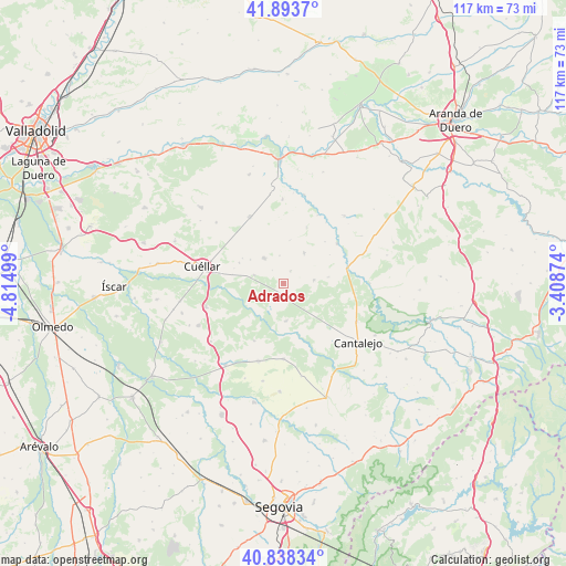
Adrados GPS coordinates[2]
41° 22' 5.376" North, 4° 6' 42.696" West
| Map corner | latitude | longitude |
|---|---|---|
| Upper-left | 41.8937°, | -4.81499° |
| Center: | 41.36816°, | -4.11186° |
| Lower-right: | 40.83834°, | -3.40874° |
| Map W x H: | 117.3×117.3 km | = 72.9×72.9mi |
| max Lat: | 43.74134° ⇑43.3% North |
| Adrados: | 41.36816° |
| min Lat: | ⇓56.7% South 27.64134° |
| min Long | Adrados | max Long |
| -18.00367° | -4.11186° | 4.2899° |
| W 38.6%⇐ | ⇒61.4% E |
Elevation
Elevation of Adrados is 885 m = 2904 ft, and this is 287 m = 942 ft above average elevation for this country.
| Max E: |
1682 m = 5518 ft | 21.5% |
| Adrados | 885 m 2904 ft | |
| Avg. | 598 m = 1962 ft | |
Min E: |
0 m = 0 ft | 78.5% |
See also: Spain elevation on elevation.city.
Geographical zone
Adrados is located in North temperate zone (between Tropic of Cancer and the Arctic Circle). Distance of this Northern Tropic circle is 1993.8 km =1238.9 mi to South.| Distance of | km | miles | from Adrados |
|---|---|---|---|
| North Pole | 5407.4 | 3360 | to North |
| Arctic Circle | 2801.5 | 1740.8 | to North |
| Tropic Cancer | 1993.8 | 1238.9 | to South |
| Equator | 4599.7 | 2858.1 | to South |


Nearby cities:
15 places around Adrados: (largest is in red/bold)
• Aldeasoña
12.5 km =7.8 mi,  21°
21°
• Cozuelos de Fuentidueña
2.9 km =1.8 mi,  28°
28°
• Frumales
6.4 km =4 mi,  285°
285°
• Fuente el Olmo de Fuentidueña
9.3 km =5.8 mi,  82°
82°
• Fuentepiñel
6.7 km =4.2 mi,  59°
59°
• Fuentesaúco de Fuentidueña
7.5 km =4.7 mi, 33°
• Fuentidueña
13.8 km =8.6 mi,  53°
53°
• Hontalbilla
2.6 km =1.6 mi,  197°
197°
• Lastras de Cuéllar
7.9 km =4.9 mi,  176°
176°
• Membibre de la Hoz
9.2 km =5.7 mi,  8°
8°
• Navalilla
15.3 km =9.5 mi,  101°
101°
• Olombrada
6.6 km =4.1 mi,  321°
321°
• Perosillo
3.7 km =2.3 mi, 318°
• Torrecilla del Pinar
6.2 km =3.9 mi, 84°
• Zarzuela del Pinar
13.5 km =8.4 mi,  206°
206°
Sources, notices
• [Note1] Compared only with cities in Spain existing in our database
• [Src1] Map data: © OpenStreetMap contributors (CC-BY-SA)
• [Src2] Other city data from geonames.org with taken over terms of usage.
• [Src3] Geographical zone / Annual Mean Temperature by Robert A. Rohde @ Wikipedia
