Fuentecambrón geodata
Fuentecambrón (Castille and León) is a seat of a third-order administrative division; located in Spain in Europe/Madrid (GMT+2) time zone. With population of 54 people, there are 6416 cities with bigger population in this country. Compared to other cities in Spain, 60.9% of cities are located further ↓South; 50.1% of cities are located further ←West and 89% of cities have lower elevation than Fuentecambrón. Note1
Administrative division(s):
- Level 1: Castille and León
- Level 2: Provincia de Soria
- Level 3: Fuentecambrón


Fuentecambrón GPS coordinates[2]
41° 30' 20.844" North, 3° 19' 43.392" West
| Map corner | latitude | longitude |
|---|---|---|
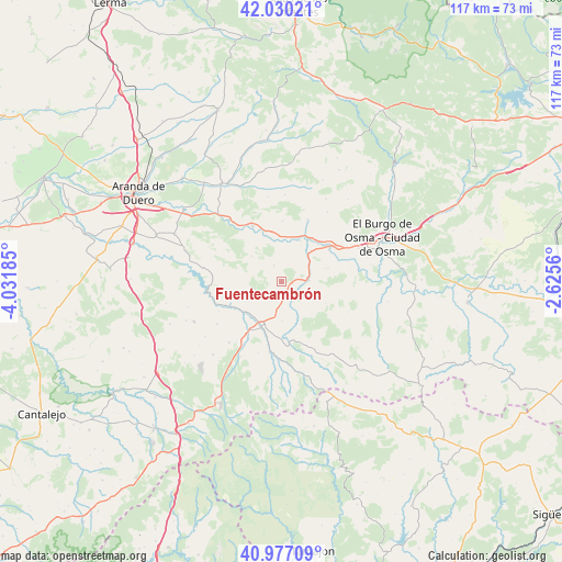
| Upper-left | 42.03021°, | -4.03185° |
| Center: | 41.50579°, | -3.32872° |
| Lower-right: | 40.97709°, | -2.6256° |
| Map W x H: | 117.1×117.1 km | = 72.8×72.8mi |
| max Lat: | 43.74134° ⇑39.1% North |
| Fuentecambrón: | 41.50579° |
| min Lat: | ⇓60.9% South 27.64134° |
| min Long | Fuentecambrón | max Long |
| -18.00367° | -3.32872° | 4.2899° |
| W 50.1%⇐ | ⇒49.9% E |
Elevation
Elevation of Fuentecambrón is 1015 m = 3330 ft, and this is 417 m = 1368 ft above average elevation for this country.
| Max E: |
1682 m = 5518 ft | 11% |
| Fuentecambrón | 1015 m 3330 ft | |
| Avg. | 598 m = 1962 ft | |
Min E: |
0 m = 0 ft | 89% |
See also: Spain elevation on elevation.city.
Geographical zone
Fuentecambrón is located in North temperate zone (between Tropic of Cancer and the Arctic Circle). Distance of this Northern Tropic circle is 2009.1 km =1248.4 mi to South.| Distance of | km | miles | from Fuentecambrón |
|---|---|---|---|
| North Pole | 5392.1 | 3350.5 | to North |
| Arctic Circle | 2786.2 | 1731.3 | to North |
| Tropic Cancer | 2009.1 | 1248.4 | to South |
| Equator | 4615 | 2867.6 | to South |


Nearby cities:
15 places around Fuentecambrón: (largest is in red/bold)
• Alconada de Maderuelo
14.5 km =9 mi,  244°
244°
• Aldealengua de Santa María
12.5 km =7.8 mi,  247°
247°
• Ayllón
10.4 km =6.5 mi,  201°
201°
• Campo de San Pedro
20 km =12.4 mi, 245°
• Castillejo de Robledo
15.2 km =9.4 mi,  292°
292°
• Corral de Ayllón
16.7 km =10.4 mi,  220°
220°
• Langa de Duero
13 km =8.1 mi,  332°
332°
• Languilla
10.1 km =6.3 mi,  231°
231°
• Liceras
15.7 km =9.8 mi,  153°
153°
• Maderuelo
16.3 km =10.1 mi,  262°
262°
• Miño de San Esteban
3.6 km =2.2 mi,  336°
336°
• Montejo de Tiermes
18.7 km =11.6 mi,  144°
144°
• Riaguas de San Bartolomé
16 km =9.9 mi, 236°
• Ribota
17.8 km =11.1 mi,  208°
208°
• San Esteban de Gormaz
12.9 km =8 mi,  53°
53°
Sources, notices
• [Note1] Compared only with cities in Spain existing in our database
• [Src1] Map data: © OpenStreetMap contributors (CC-BY-SA)
• [Src2] Other city data from geonames.org with taken over terms of usage.
• [Src3] Geographical zone / Annual Mean Temperature by Robert A. Rohde @ Wikipedia
