Miño de San Esteban geodata
Miño de San Esteban (Castille and León) is a seat of a third-order administrative division; located in Spain in Europe/Madrid (GMT+2) time zone. With population of 76 people, there are 6179 cities with bigger population in this country. Compared to other cities in Spain, 61.7% of cities are located further ↓South; 50.1% of cities are located further →East and 84.1% of cities have lower elevation than Miño de San Esteban. Note1
Administrative division(s):
- Level 1: Castille and León
- Level 2: Provincia de Soria
- Level 3: Miño de San Esteban


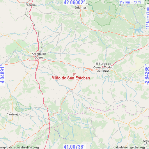
Miño de San Esteban GPS coordinates[2]
41° 32' 9.024" North, 3° 20' 44.844" West
| Map corner | latitude | longitude |
|---|---|---|
| Upper-left | 42.06002°, | -4.04891° |
| Center: | 41.53584°, | -3.34579° |
| Lower-right: | 41.00738°, | -2.64266° |
| Map W x H: | 117×117 km | = 72.7×72.7mi |
| max Lat: | 43.74134° ⇑38.3% North |
| Miño de San Esteban: | 41.53584° |
| min Lat: | ⇓61.7% South 27.64134° |
| min Long | Miño de San Es | max Long |
| -18.00367° | -3.34579° | 4.2899° |
| W 49.9%⇐ | ⇒50.1% E |
Elevation
Elevation of Miño de San Esteban is 941 m = 3087 ft, and this is 343 m = 1125 ft above average elevation for this country.
| Max E: |
1682 m = 5518 ft | 15.9% |
| Miño de San Esteban | 941 m 3087 ft | |
| Avg. | 598 m = 1962 ft | |
Min E: |
0 m = 0 ft | 84.1% |
See also: Spain elevation on elevation.city.
Geographical zone
Miño de San Esteban is located in North temperate zone (between Tropic of Cancer and the Arctic Circle). Distance of this Northern Tropic circle is 2012.4 km =1250.4 mi to South.| Distance of | km | miles | from Miño de San Esteban |
|---|---|---|---|
| North Pole | 5388.7 | 3348.4 | to North |
| Arctic Circle | 2782.8 | 1729.2 | to North |
| Tropic Cancer | 2012.4 | 1250.4 | to South |
| Equator | 4618.4 | 2869.7 | to South |


Nearby cities:
15 places around Miño de San Esteban: (largest is in red/bold)
• Alconada de Maderuelo
15 km =9.3 mi,  230°
230°
• Aldealengua de Santa María
13 km =8.1 mi, 230°
• Ayllón
13.2 km =8.2 mi,  190°
190°
• Brazacorta
20.3 km =12.6 mi,  354°
354°
• Castillejo de Robledo
12.8 km =8 mi,  281°
281°
• Corral de Ayllón
18.7 km =11.6 mi,  210°
210°
• Fuentecambrón
3.6 km =2.2 mi,  156°
156°
• Langa de Duero
9.4 km =5.8 mi,  331°
331°
• Languilla
11.6 km =7.2 mi, 214°
• Liceras
19.4 km =12.1 mi,  153°
153°
• Maderuelo
15.7 km =9.8 mi,  249°
249°
• Peñaranda de Duero
20.2 km =12.6 mi, 326°
• Riaguas de San Bartolomé
17 km =10.6 mi,  224°
224°
• Ribota
20.3 km =12.6 mi,  200°
200°
• San Esteban de Gormaz
12.5 km =7.8 mi,  70°
70°
Sources, notices
• [Note1] Compared only with cities in Spain existing in our database
• [Src1] Map data: © OpenStreetMap contributors (CC-BY-SA)
• [Src2] Other city data from geonames.org with taken over terms of usage.
• [Src3] Geographical zone / Annual Mean Temperature by Robert A. Rohde @ Wikipedia
