Fombellida geodata
Fombellida (Castille and León) is a seat of a third-order administrative division; located in Spain in Europe/Madrid (GMT+2) time zone. With population of 245 people, there are 4773 cities with bigger population in this country. Compared to other cities in Spain, 67.8% of cities are located further ↓South; 62.4% of cities are located further →East and 67.2% of cities have lower elevation than Fombellida. Note1
Administrative division(s):
- Level 1: Castille and León
- Level 2: Provincia de Valladolid
- Level 3: Fombellida


Fombellida GPS coordinates[2]
41° 46' 0.948" North, 4° 11' 2.724" West
| Map corner | latitude | longitude |
|---|---|---|
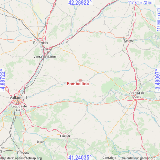
| Upper-left | 42.28922°, | -4.88722° |
| Center: | 41.76693°, | -4.18409° |
| Lower-right: | 41.24035°, | -3.48097° |
| Map W x H: | 116.6×116.6 km | = 72.5×72.5mi |
| max Lat: | 43.74134° ⇑32.2% North |
| Fombellida: | 41.76693° |
| min Lat: | ⇓67.8% South 27.64134° |
| min Long | Fombellida | max Long |
| -18.00367° | -4.18409° | 4.2899° |
| W 37.6%⇐ | ⇒62.4% E |
Elevation
Elevation of Fombellida is 793 m = 2602 ft, and this is 195 m = 640 ft above average elevation for this country.
| Max E: |
1682 m = 5518 ft | 32.8% |
| Fombellida | 793 m 2602 ft | |
| Avg. | 598 m = 1962 ft | |
Min E: |
0 m = 0 ft | 67.2% |
See also: Spain elevation on elevation.city.
Geographical zone
Fombellida is located in North temperate zone (between Tropic of Cancer and the Arctic Circle). Distance of this Northern Tropic circle is 2038.1 km =1266.4 mi to South.| Distance of | km | miles | from Fombellida |
|---|---|---|---|
| North Pole | 5363 | 3332.4 | to North |
| Arctic Circle | 2757.1 | 1713.2 | to North |
| Tropic Cancer | 2038.1 | 1266.4 | to South |
| Equator | 4644 | 2885.6 | to South |


Nearby cities:
15 places around Fombellida: (largest is in red/bold)
• Amusquillo
9.9 km =6.2 mi,  258°
258°
• Canillas de Esgueva
5.1 km =3.2 mi,  105°
105°
• Castrillo de Don Juan
9.8 km =6.1 mi,  74°
74°
• Castroverde de Cerrato
3.3 km =2.1 mi,  248°
248°
• Cevico Navero
10.5 km =6.5 mi,  359°
359°
• Encinas de Esgueva
6.8 km =4.2 mi,  99°
99°
• Hérmedes de Cerrato
5.9 km =3.7 mi,  8°
8°
• Piñel de Abajo
10.7 km =6.6 mi,  163°
163°
• Piñel de Arriba
8.8 km =5.5 mi,  148°
148°
• Roturas
12.3 km =7.6 mi, 153°
• San Llorente
13.3 km =8.3 mi,  132°
132°
• Torre de Esgueva
1.3 km =0.8 mi,  276°
276°
• Villaco
7.6 km =4.7 mi, 246°
• Villaconancio
12.1 km =7.5 mi,  344°
344°
• Villafuerte
12.1 km =7.5 mi, 252°
Sources, notices
• [Note1] Compared only with cities in Spain existing in our database
• [Src1] Map data: © OpenStreetMap contributors (CC-BY-SA)
• [Src2] Other city data from geonames.org with taken over terms of usage.
• [Src3] Geographical zone / Annual Mean Temperature by Robert A. Rohde @ Wikipedia
