Duruelo geodata
Duruelo (Castille and León) is a seat of a third-order administrative division; located in Spain in Europe/Madrid (GMT+2) time zone. With population of 140 people, there are 5501 cities with bigger population in this country. Compared to other cities in Spain, 54.2% of cities are located further ↓South; 54.5% of cities are located further →East and 88.8% of cities have lower elevation than Duruelo. Note1
Administrative division(s):
- Level 1: Castille and León
- Level 2: Provincia de Segovia
- Level 3: Duruelo


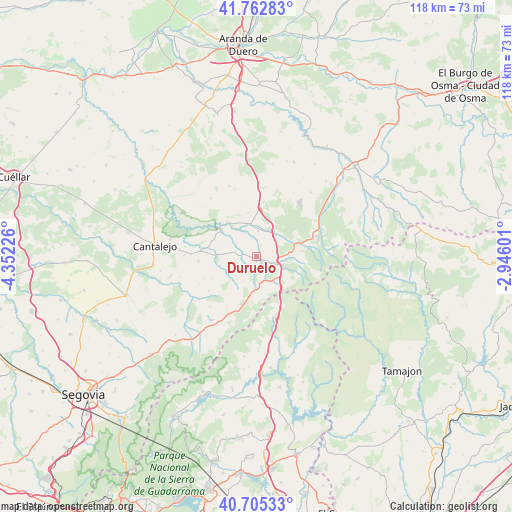
Duruelo GPS coordinates[2]
41° 14' 10.392" North, 3° 38' 56.904" West
| Map corner | latitude | longitude |
|---|---|---|
| Upper-left | 41.76283°, | -4.35226° |
| Center: | 41.23622°, | -3.64914° |
| Lower-right: | 40.70533°, | -2.94601° |
| Map W x H: | 117.6×117.6 km | = 73.1×73.1mi |
| max Lat: | 43.74134° ⇑45.8% North |
| Duruelo: | 41.23622° |
| min Lat: | ⇓54.2% South 27.64134° |
| min Long | Duruelo | max Long |
| -18.00367° | -3.64914° | 4.2899° |
| W 45.5%⇐ | ⇒54.5% E |
Elevation
Elevation of Duruelo is 1011 m = 3317 ft, and this is 413 m = 1355 ft above average elevation for this country.
| Max E: |
1682 m = 5518 ft | 11.2% |
| Duruelo | 1011 m 3317 ft | |
| Avg. | 598 m = 1962 ft | |
Min E: |
0 m = 0 ft | 88.8% |
See also: Spain elevation on elevation.city.
Geographical zone
Duruelo is located in North temperate zone (between Tropic of Cancer and the Arctic Circle). Distance of this Northern Tropic circle is 1979.1 km =1229.8 mi to South.| Distance of | km | miles | from Duruelo |
|---|---|---|---|
| North Pole | 5422 | 3369.1 | to North |
| Arctic Circle | 2816.1 | 1749.8 | to North |
| Tropic Cancer | 1979.1 | 1229.8 | to South |
| Equator | 4585 | 2849 | to South |


Nearby cities:
15 places around Duruelo: (largest is in red/bold)
• Aldealcorvo
11.9 km =7.4 mi,  274°
274°
• Aldeonte
13 km =8.1 mi,  349°
349°
• Barbolla
10.2 km =6.3 mi, 348°
• Boceguillas
11.2 km =7 mi,  4°
4°
• Casla
7.8 km =4.8 mi,  184°
184°
• Castillejo de Mesleón
6.4 km =4 mi,  38°
38°
• Castroserna de Abajo
7.7 km =4.8 mi,  246°
246°
• Cerezo de Abajo
5.2 km =3.2 mi,  112°
112°
• Cerezo de Arriba
7.6 km =4.7 mi,  87°
87°
• Prádena
11.3 km =7 mi,  196°
196°
• Santa Marta del Cerro
3.6 km =2.2 mi,  237°
237°
• Sepúlveda
10.3 km =6.4 mi,  310°
310°
• Somosierra
12.8 km =8 mi,  154°
154°
• Sotillo
2.7 km =1.7 mi,  21°
21°
• Valleruela de Sepúlveda
11.7 km =7.3 mi, 242°
Sources, notices
• [Note1] Compared only with cities in Spain existing in our database
• [Src1] Map data: © OpenStreetMap contributors (CC-BY-SA)
• [Src2] Other city data from geonames.org with taken over terms of usage.
• [Src3] Geographical zone / Annual Mean Temperature by Robert A. Rohde @ Wikipedia
