Prádena geodata
Prádena (Castille and León) is a seat of a third-order administrative division; located in Spain in Europe/Madrid (GMT+1) time zone. With population of 542 people, there are 3757 cities with bigger population in this country. Compared to other cities in Spain, 51.9% of cities are located further ↓South; 55.2% of cities are located further →East and 94.3% of cities have lower elevation than Prádena. Note1
Administrative division(s):
- Level 1: Castille and León
- Level 2: Provincia de Segovia
- Level 3: Prádena


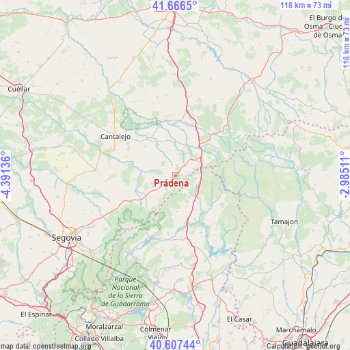
Prádena GPS coordinates[2]
41° 8' 20.796" North, 3° 41' 17.628" West
| Map corner | latitude | longitude |
|---|---|---|
| Upper-left | 41.6665°, | -4.39136° |
| Center: | 41.13911°, | -3.68823° |
| Lower-right: | 40.60744°, | -2.98511° |
| Map W x H: | 117.8×117.8 km | = 73.2×73.2mi |
| max Lat: | 43.74134° ⇑48.1% North |
| Prádena: | 41.13911° |
| min Lat: | ⇓51.9% South 27.64134° |
| min Long | Prádena | max Long |
| -18.00367° | -3.68823° | 4.2899° |
| W 44.8%⇐ | ⇒55.2% E |
Elevation
Elevation of Prádena is 1123 m = 3684 ft, and this is 525 m = 1722 ft above average elevation for this country.
| Max E: |
1682 m = 5518 ft | 5.7% |
| Prádena | 1123 m 3684 ft | |
| Avg. | 598 m = 1962 ft | |
Min E: |
0 m = 0 ft | 94.3% |
See also: Spain elevation on elevation.city.
Geographical zone
Prádena is located in North temperate zone (between Tropic of Cancer and the Arctic Circle). Distance of this Northern Tropic circle is 1968.3 km =1223 mi to South.| Distance of | km | miles | from Prádena |
|---|---|---|---|
| North Pole | 5432.8 | 3375.8 | to North |
| Arctic Circle | 2826.9 | 1756.6 | to North |
| Tropic Cancer | 1968.3 | 1223 | to South |
| Equator | 4574.2 | 2842.3 | to South |


Nearby cities:
15 places around Prádena: (largest is in red/bold)
• Arcones
3.8 km =2.4 mi,  232°
232°
• Braojos
11.6 km =7.2 mi,  161°
161°
• Casla
4 km =2.5 mi,  41°
41°
• Castroserna de Abajo
8.6 km =5.3 mi,  333°
333°
• Cerezo de Abajo
12 km =7.5 mi, 42°
• Duruelo
11.3 km =7 mi,  16°
16°
• Gallegos
10.8 km =6.7 mi, 228°
• Horcajo de la Sierra
11.8 km =7.3 mi,  132°
132°
• Matabuena
7.6 km =4.7 mi, 230°
• Pedraza
10.3 km =6.4 mi,  264°
264°
• Robregordo
8.7 km =5.4 mi,  114°
114°
• Santa Marta del Cerro
8.8 km =5.5 mi,  1°
1°
• Somosierra
8.9 km =5.5 mi,  94°
94°
• Valleruela de Pedraza
10.9 km =6.8 mi,  294°
294°
• Valleruela de Sepúlveda
8.9 km =5.5 mi,  307°
307°
Sources, notices
• [Note1] Compared only with cities in Spain existing in our database
• [Src1] Map data: © OpenStreetMap contributors (CC-BY-SA)
• [Src2] Other city data from geonames.org with taken over terms of usage.
• [Src3] Geographical zone / Annual Mean Temperature by Robert A. Rohde @ Wikipedia
