Caspueñas geodata
Caspueñas (Castille-La Mancha) is a seat of a third-order administrative division; located in Spain in Europe/Madrid (GMT+2) time zone. With population of 96 people, there are 5985 cities with bigger population in this country. Compared to other cities in Spain, 58.1% of cities are located further ↑North; 54.9% of cities are located further ←West and 77.4% of cities have lower elevation than Caspueñas. Note1
Administrative division(s):
- Level 1: Castille-La Mancha
- Level 2: Provincia de Guadalajara
- Level 3: Caspueñas


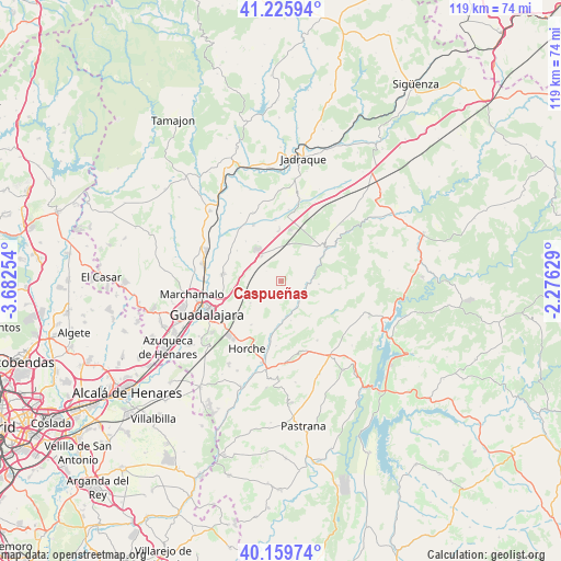
Caspueñas GPS coordinates[2]
40° 41' 41.892" North, 2° 58' 45.876" West
| Map corner | latitude | longitude |
|---|---|---|
| Upper-left | 41.22594°, | -3.68254° |
| Center: | 40.69497°, | -2.97941° |
| Lower-right: | 40.15974°, | -2.27629° |
| Map W x H: | 118.6×118.5 km | = 73.7×73.6mi |
| max Lat: | 43.74134° ⇑58.1% North |
| Caspueñas: | 40.69497° |
| min Lat: | ⇓41.9% South 27.64134° |
| min Long | Caspueñas | max Long |
| -18.00367° | -2.97941° | 4.2899° |
| W 54.9%⇐ | ⇒45.1% E |
Elevation
Elevation of Caspueñas is 874 m = 2867 ft, and this is 276 m = 906 ft above average elevation for this country.
| Max E: |
1682 m = 5518 ft | 22.6% |
| Caspueñas | 874 m 2867 ft | |
| Avg. | 598 m = 1962 ft | |
Min E: |
0 m = 0 ft | 77.4% |
See also: Spain elevation on elevation.city.
Geographical zone
Caspueñas is located in North temperate zone (between Tropic of Cancer and the Arctic Circle). Distance of this Northern Tropic circle is 1918.9 km =1192.3 mi to South.| Distance of | km | miles | from Caspueñas |
|---|---|---|---|
| North Pole | 5482.2 | 3406.5 | to North |
| Arctic Circle | 2876.3 | 1787.2 | to North |
| Tropic Cancer | 1918.9 | 1192.3 | to South |
| Equator | 4524.9 | 2811.6 | to South |


Nearby cities:
15 places around Caspueñas: (largest is in red/bold)
• Aldeanueva de Guadalajara
5.7 km =3.5 mi,  252°
252°
• Atanzón
3.4 km =2.1 mi,  205°
205°
• Brihuega
11.8 km =7.3 mi,  51°
51°
• Cañizar
10.8 km =6.7 mi,  318°
318°
• Centenera
7.8 km =4.8 mi,  230°
230°
• Ciruelas
10.9 km =6.8 mi,  304°
304°
• Irueste
11.9 km =7.4 mi,  140°
140°
• Lupiana
11.4 km =7.1 mi, 212°
• Torija
6.7 km =4.2 mi, 322°
• Trijueque
8.9 km =5.5 mi,  352°
352°
• Tórtola de Henares
12.2 km =7.6 mi,  274°
274°
• Valdeavellano
3.4 km =2.1 mi,  166°
166°
• Valdegrudas
3.3 km =2.1 mi, 303°
• Valfermoso de Tajuña
8.7 km =5.4 mi, 165°
• Yélamos de Abajo
12.5 km =7.8 mi,  124°
124°
Sources, notices
• [Note1] Compared only with cities in Spain existing in our database
• [Src1] Map data: © OpenStreetMap contributors (CC-BY-SA)
• [Src2] Other city data from geonames.org with taken over terms of usage.
• [Src3] Geographical zone / Annual Mean Temperature by Robert A. Rohde @ Wikipedia
