Carrascal de Barregas geodata
Carrascal de Barregas (Castille and León) is a seat of a third-order administrative division; located in Spain in Europe/Madrid (GMT+2) time zone. With population of 567 people, there are 3690 cities with bigger population in this country. Compared to other cities in Spain, 52.1% of cities are located further ↑North; 82.7% of cities are located further →East and 67.5% of cities have lower elevation than Carrascal de Barregas. Note1
Administrative division(s):
- Level 1: Castille and León
- Level 2: Provincia de Salamanca
- Level 3: Carrascal de Barregas
Current local time in Carrascal de Barregas:
11:53 PM, ThursdayDifference from your time zone: hours


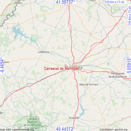
Carrascal de Barregas GPS coordinates[2]
40° 58' 43.248" North, 5° 45' 44.172" West
| Map corner | latitude | longitude |
|---|---|---|
| Upper-left | 41.50737°, | -6.4654° |
| Center: | 40.97868°, | -5.76227° |
| Lower-right: | 40.44572°, | -5.05915° |
| Map W x H: | 118×118 km | = 73.3×73.3mi |
| max Lat: | 43.74134° ⇑52.1% North |
| Carrascal de Barregas: | 40.97868° |
| min Lat: | ⇓47.9% South 27.64134° |
| min Long | Carrascal de Ba | max Long |
| -18.00367° | -5.76227° | 4.2899° |
| W 17.3%⇐ | ⇒82.7% E |
Elevation
Elevation of Carrascal de Barregas is 795 m = 2608 ft, and this is 197 m = 646 ft above average elevation for this country.
| Max E: |
1682 m = 5518 ft | 32.5% |
| Carrascal de Barregas | 795 m 2608 ft | |
| Avg. | 598 m = 1962 ft | |
Min E: |
0 m = 0 ft | 67.5% |
See also: Spain elevation on elevation.city.
Geographical zone
Carrascal de Barregas is located in North temperate zone (between Tropic of Cancer and the Arctic Circle). Distance of this Northern Tropic circle is 1950.5 km =1212 mi to South.| Distance of | km | miles | from Carrascal de Barregas |
|---|---|---|---|
| North Pole | 5450.7 | 3386.9 | to North |
| Arctic Circle | 2844.8 | 1767.7 | to North |
| Tropic Cancer | 1950.5 | 1212 | to South |
| Equator | 4556.4 | 2831.2 | to South |


Nearby cities:
15 places around Carrascal de Barregas: (largest is in red/bold)
• Aldeatejada
8.6 km =5.3 mi,  137°
137°
• Almenara de Tormes
10.8 km =6.7 mi,  331°
331°
• Carbajosa de la Sagrada
10.7 km =6.6 mi,  118°
118°
• Castellanos de Villiquera
9.9 km =6.2 mi,  35°
35°
• Doñinos de Salamanca
2.6 km =1.6 mi, 143°
• Florida de Liébana
5 km =3.1 mi,  359°
359°
• Galindo y Perahuy
10.2 km =6.3 mi,  247°
247°
• Monterrubio de Armuña
11.3 km =7 mi,  61°
61°
• Parada de Arriba
2.7 km =1.7 mi,  288°
288°
• Salamanca
8.3 km =5.2 mi,  97°
97°
• San Pedro del Valle
10.2 km =6.3 mi,  306°
306°
• Valverdón
7.6 km =4.7 mi, 355°
• Villamayor
6 km =3.7 mi,  67°
67°
• Villares de la Reina
10.1 km =6.3 mi, 70°
• Zarapicos
9.6 km =6 mi, 313°
Sources, notices
• [Note1] Compared only with cities in Spain existing in our database
• [Src1] Map data: © OpenStreetMap contributors (CC-BY-SA)
• [Src2] Other city data from geonames.org with taken over terms of usage.
• [Src3] Geographical zone / Annual Mean Temperature by Robert A. Rohde @ Wikipedia
