Candeleda geodata
Candeleda (Castille and León) is a seat of a third-order administrative division; located in Spain in Europe/Madrid (GMT+2) time zone. With population of 5,062 people, there are 1289 cities with bigger population in this country. Compared to other cities in Spain, 67.9% of cities are located further ↑North; 75.6% of cities are located further →East and 67.1% of cities have higher elevation than Candeleda. Note1
Administrative division(s):
- Level 1: Castille and León
- Level 2: Provincia de Ávila
- Level 3: Candeleda


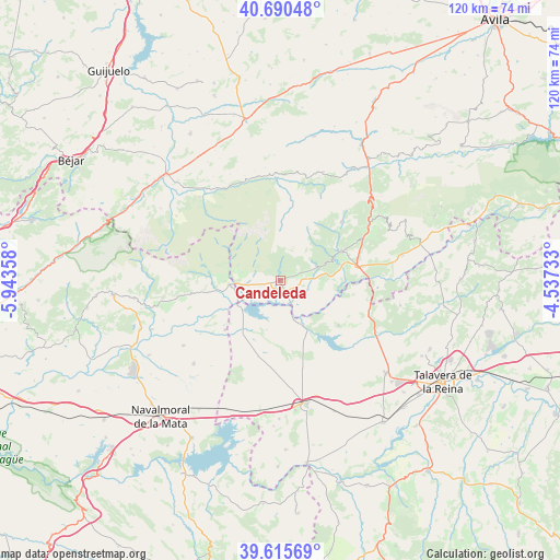
Candeleda GPS coordinates[2]
40° 9' 18.756" North, 5° 14' 25.62" West
| Map corner | latitude | longitude |
|---|---|---|
| Upper-left | 40.69048°, | -5.94358° |
| Center: | 40.15521°, | -5.24045° |
| Lower-right: | 39.61569°, | -4.53733° |
| Map W x H: | 119.5×119.5 km | = 74.3×74.3mi |
| max Lat: | 43.74134° ⇑67.9% North |
| Candeleda: | 40.15521° |
| min Lat: | ⇓32.1% South 27.64134° |
| min Long | Candeleda | max Long |
| -18.00367° | -5.24045° | 4.2899° |
| W 24.4%⇐ | ⇒75.6% E |
Elevation
Elevation of Candeleda is 431 m = 1414 ft, and this is 167 m = 548 ft below average elevation for this country.
| Max E: |
1682 m = 5518 ft | 67.1% |
| Avg. | 598 m = 1962 ft | |
| Candeleda | 431 m = 1414 ft | |
Min E: |
0 m = 0 ft | 32.9% |
See also: Spain elevation on elevation.city.
Geographical zone
Candeleda is located in North temperate zone (between Tropic of Cancer and the Arctic Circle). Distance of this Northern Tropic circle is 1858.9 km =1155.1 mi to South.| Distance of | km | miles | from Candeleda |
|---|---|---|---|
| North Pole | 5542.2 | 3443.8 | to North |
| Arctic Circle | 2936.3 | 1824.5 | to North |
| Tropic Cancer | 1858.9 | 1155.1 | to South |
| Equator | 4464.8 | 2774.3 | to South |


Nearby cities:
15 places around Candeleda: (largest is in red/bold)
• Arenas de San Pedro
14.4 km =8.9 mi,  64°
64°
• Guisando
11.4 km =7.1 mi,  48°
48°
• Hoyos del Collado
23 km =14.3 mi,  8°
8°
• Hoyos del Espino
23 km =14.3 mi, 13°
• Madrigal de la Vera
10.9 km =6.8 mi,  265°
265°
• Mombeltrán
22.2 km =13.8 mi, 58°
• Navalcán
16.6 km =10.3 mi,  126°
126°
• Navalperal de Tormes
22.6 km =14 mi,  346°
346°
• Parrillas
18.2 km =11.3 mi,  124°
124°
• Poyales del Hoyo
6.6 km =4.1 mi,  73°
73°
• Pueblonuevo de Miramontes
15.8 km =9.8 mi,  228°
228°
• Santa Cruz del Valle
23 km =14.3 mi, 62°
• Valverde de la Vera
22 km =13.7 mi,  260°
260°
• Villanueva de la Vera
19.1 km =11.9 mi, 261°
• Zapardiel de la Ribera
23.5 km =14.6 mi,  341°
341°
Sources, notices
• [Note1] Compared only with cities in Spain existing in our database
• [Src1] Map data: © OpenStreetMap contributors (CC-BY-SA)
• [Src2] Other city data from geonames.org with taken over terms of usage.
• [Src3] Geographical zone / Annual Mean Temperature by Robert A. Rohde @ Wikipedia
