Arenas de San Pedro geodata
Arenas de San Pedro (Castille and León) is a seat of a third-order administrative division; located in Spain in Europe/Madrid (GMT+2) time zone. With population of 6,539 people, there are 1082 cities with bigger population in this country. Compared to other cities in Spain, 67% of cities are located further ↑North; 73.6% of cities are located further →East and 59.8% of cities have higher elevation than Arenas de San Pedro. Note1
Administrative division(s):
- Level 1: Castille and León
- Level 2: Provincia de Ávila
- Level 3: Arenas de San Pedro


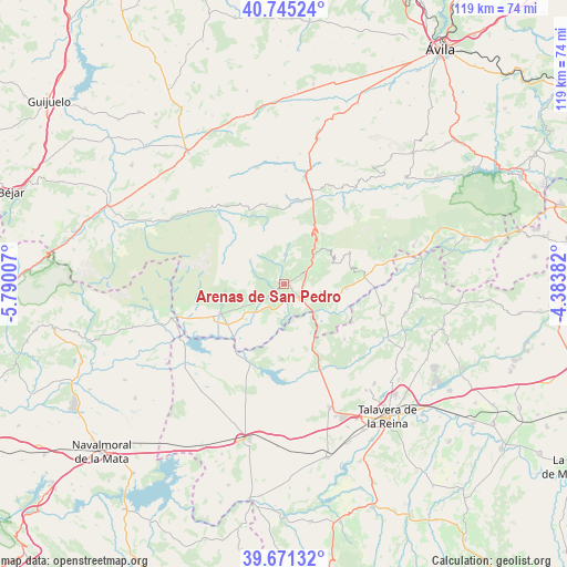
Arenas de San Pedro GPS coordinates[2]
40° 12' 37.476" North, 5° 5' 12.984" West
| Map corner | latitude | longitude |
|---|---|---|
| Upper-left | 40.74524°, | -5.79007° |
| Center: | 40.21041°, | -5.08694° |
| Lower-right: | 39.67132°, | -4.38382° |
| Map W x H: | 119.4×119.4 km | = 74.2×74.2mi |
| max Lat: | 43.74134° ⇑67% North |
| Arenas de San Pedro: | 40.21041° |
| min Lat: | ⇓33% South 27.64134° |
| min Long | Arenas de San P | max Long |
| -18.00367° | -5.08694° | 4.2899° |
| W 26.4%⇐ | ⇒73.6% E |
Elevation
Elevation of Arenas de San Pedro is 531 m = 1742 ft, and this is 67 m = 220 ft below average elevation for this country.
| Max E: |
1682 m = 5518 ft | 59.8% |
| Avg. | 598 m = 1962 ft | |
| Arenas de San Pedro | 531 m = 1742 ft | |
Min E: |
0 m = 0 ft | 40.2% |
See also: Spain elevation on elevation.city.
Geographical zone
Arenas de San Pedro is located in North temperate zone (between Tropic of Cancer and the Arctic Circle). Distance of this Northern Tropic circle is 1865.1 km =1158.9 mi to South.| Distance of | km | miles | from Arenas de San Pedro |
|---|---|---|---|
| North Pole | 5536.1 | 3440 | to North |
| Arctic Circle | 2930.2 | 1820.7 | to North |
| Tropic Cancer | 1865.1 | 1158.9 | to South |
| Equator | 4471 | 2778.1 | to South |


Nearby cities:
15 places around Arenas de San Pedro: (largest is in red/bold)
• Candeleda
14.4 km =8.9 mi,  244°
244°
• Cuevas del Valle
11.4 km =7.1 mi,  35°
35°
• Guisando
4.7 km =2.9 mi,  286°
286°
• Lanzahita
12.9 km =8 mi,  92°
92°
• Mombeltrán
8.1 km =5 mi,  46°
46°
• Montesclaros
17.1 km =10.6 mi,  132°
132°
• Navalcán
16 km =9.9 mi,  178°
178°
• Navarredonda de Gredos
17.2 km =10.7 mi,  346°
346°
• Parrillas
16.6 km =10.3 mi,  173°
173°
• Pedro Bernardo
15.5 km =9.6 mi,  76°
76°
• Poyales del Hoyo
7.9 km =4.9 mi, 237°
• San Esteban del Valle
11.4 km =7.1 mi, 51°
• San Martín del Pimpollar
17.8 km =11.1 mi,  8°
8°
• Santa Cruz del Valle
8.6 km =5.3 mi,  57°
57°
• Villarejo del Valle
11.4 km =7.1 mi, 42°
Sources, notices
• [Note1] Compared only with cities in Spain existing in our database
• [Src1] Map data: © OpenStreetMap contributors (CC-BY-SA)
• [Src2] Other city data from geonames.org with taken over terms of usage.
• [Src3] Geographical zone / Annual Mean Temperature by Robert A. Rohde @ Wikipedia
