Cañamaque geodata
Cañamaque (Castille and León) is a seat of a third-order administrative division; located in Spain in Europe/Madrid (GMT+2) time zone. With population of 43 people, there are 6531 cities with bigger population in this country. Compared to other cities in Spain, 59.4% of cities are located further ↓South; 64.3% of cities are located further ←West and 86.1% of cities have lower elevation than Cañamaque. Note1
Administrative division(s):
- Level 1: Castille and León
- Level 2: Provincia de Soria
- Level 3: Cañamaque


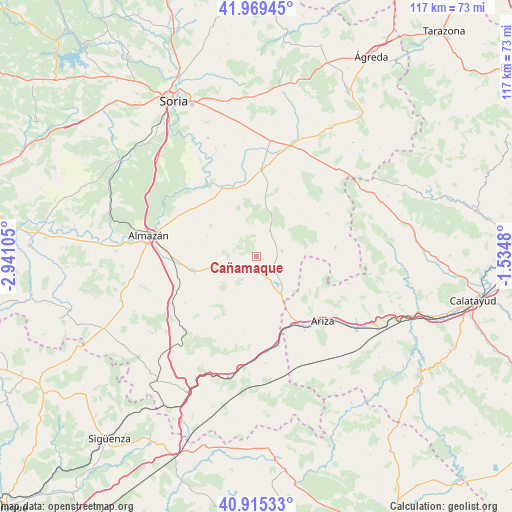
Cañamaque GPS coordinates[2]
41° 26' 40.308" North, 2° 14' 16.512" West
| Map corner | latitude | longitude |
|---|---|---|
| Upper-left | 41.96945°, | -2.94105° |
| Center: | 41.44453°, | -2.23792° |
| Lower-right: | 40.91533°, | -1.5348° |
| Map W x H: | 117.2×117.2 km | = 72.8×72.8mi |
| max Lat: | 43.74134° ⇑40.6% North |
| Cañamaque: | 41.44453° |
| min Lat: | ⇓59.4% South 27.64134° |
| min Long | Cañamaque | max Long |
| -18.00367° | -2.23792° | 4.2899° |
| W 64.3%⇐ | ⇒35.7% E |
Elevation
Elevation of Cañamaque is 966 m = 3169 ft, and this is 368 m = 1207 ft above average elevation for this country.
| Max E: |
1682 m = 5518 ft | 13.9% |
| Cañamaque | 966 m 3169 ft | |
| Avg. | 598 m = 1962 ft | |
Min E: |
0 m = 0 ft | 86.1% |
See also: Spain elevation on elevation.city.
Geographical zone
Cañamaque is located in North temperate zone (between Tropic of Cancer and the Arctic Circle). Distance of this Northern Tropic circle is 2002.3 km =1244.2 mi to South.| Distance of | km | miles | from Cañamaque |
|---|---|---|---|
| North Pole | 5398.9 | 3354.7 | to North |
| Arctic Circle | 2793 | 1735.5 | to North |
| Tropic Cancer | 2002.3 | 1244.2 | to South |
| Equator | 4608.2 | 2863.4 | to South |


Nearby cities:
15 places around Cañamaque: (largest is in red/bold)
• Alentisque
8.3 km =5.2 mi,  251°
251°
• Bliecos
9.7 km =6 mi,  343°
343°
• Bordalba
14.6 km =9.1 mi,  102°
102°
• Borjabad
16.1 km =10 mi,  318°
318°
• Escobosa de Almazán
12.1 km =7.5 mi,  292°
292°
• Maján
6 km =3.7 mi,  296°
296°
• Momblona
9.1 km =5.7 mi,  269°
269°
• Monteagudo de las Vicarías
10.5 km =6.5 mi,  147°
147°
• Morón de Almazán
15 km =9.3 mi,  256°
256°
• Nepas
16.2 km =10.1 mi, 304°
• Nolay
13.1 km =8.1 mi,  314°
314°
• Pozuel de Ariza
12.8 km =8 mi, 145°
• Soliedra
12.3 km =7.6 mi,  282°
282°
• Torlengua
6.4 km =4 mi,  79°
79°
• Velilla de los Ajos
5.3 km =3.3 mi, 343°
Sources, notices
• [Note1] Compared only with cities in Spain existing in our database
• [Src1] Map data: © OpenStreetMap contributors (CC-BY-SA)
• [Src2] Other city data from geonames.org with taken over terms of usage.
• [Src3] Geographical zone / Annual Mean Temperature by Robert A. Rohde @ Wikipedia
