Angüés geodata
Angüés (Aragon) is a seat of a third-order administrative division; located in Spain in Europe/Madrid (GMT+2) time zone. With population of 419 people, there are 4081 cities with bigger population in this country. Compared to other cities in Spain, 76.7% of cities are located further ↓South; 86% of cities are located further ←West and 58.7% of cities have higher elevation than Angüés. Note1


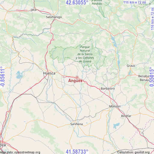
Angüés GPS coordinates[2]
42° 6' 39.924" North, 0° 9' 10.728" West
| Map corner | latitude | longitude |
|---|---|---|
| Upper-left | 42.63055°, | -0.85611° |
| Center: | 42.11109°, | -0.15298° |
| Lower-right: | 41.58733°, | 0.55015° |
| Map W x H: | 116×116 km | = 72.1×72.1mi |
| max Lat: | 43.74134° ⇑23.3% North |
| Angüés: | 42.11109° |
| min Lat: | ⇓76.7% South 27.64134° |
| min Long | Angüés | max Long |
| -18.00367° | -0.15298° | 4.2899° |
| W 86%⇐ | ⇒14% E |
Elevation
Elevation of Angüés is 544 m = 1785 ft, and this is 54 m = 177 ft below average elevation for this country.
| Max E: |
1682 m = 5518 ft | 58.7% |
| Avg. | 598 m = 1962 ft | |
| Angüés | 544 m = 1785 ft | |
Min E: |
0 m = 0 ft | 41.3% |
See also: Spain elevation on elevation.city.
Geographical zone
Angüés is located in North temperate zone (between Tropic of Cancer and the Arctic Circle). Distance of this Northern Tropic circle is 2076.4 km =1290.2 mi to South.| Distance of | km | miles | from Angüés |
|---|---|---|---|
| North Pole | 5324.7 | 3308.6 | to North |
| Arctic Circle | 2718.9 | 1689.4 | to North |
| Tropic Cancer | 2076.4 | 1290.2 | to South |
| Equator | 4682.3 | 2909.4 | to South |


Nearby cities:
15 places around Angüés: (largest is in red/bold)
• Abiego
7 km =4.3 mi,  81°
81°
• Adahuesca
12.6 km =7.8 mi,  71°
71°
• Alcalá del Obispo
12 km =7.5 mi,  251°
251°
• Antillón
8.3 km =5.2 mi,  185°
185°
• Argavieso
12.2 km =7.6 mi,  237°
237°
• Azara
11.2 km =7 mi,  113°
113°
• Azlor
9 km =5.6 mi,  101°
101°
• Barbuñales
11 km =6.8 mi,  150°
150°
• Bierge
8.1 km =5 mi,  45°
45°
• Casbas de Huesca
5.1 km =3.2 mi,  12°
12°
• Ibieca
7.2 km =4.5 mi,  320°
320°
• Peraltilla
12.8 km =8 mi,  119°
119°
• Pertusa
12.3 km =7.6 mi,  170°
170°
• Salillas
14.1 km =8.8 mi,  204°
204°
• Siétamo
10.6 km =6.6 mi,  277°
277°
Sources, notices
• [Note1] Compared only with cities in Spain existing in our database
• [Src1] Map data: © OpenStreetMap contributors (CC-BY-SA)
• [Src2] Other city data from geonames.org with taken over terms of usage.
• [Src3] Geographical zone / Annual Mean Temperature by Robert A. Rohde @ Wikipedia
