Anglesola geodata
Anglesola (Catalonia) is a seat of a third-order administrative division; located in Spain in Europe/Madrid (GMT+2) time zone. With population of 1,313 people, there are 2627 cities with bigger population in this country. Compared to other cities in Spain, 65% of cities are located further ↓South; 90.7% of cities are located further ←West and 72.5% of cities have higher elevation than Anglesola. Note1


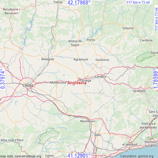
Anglesola GPS coordinates[2]
41° 39' 23.364" North, 1° 4' 58.296" East
| Map corner | latitude | longitude |
|---|---|---|
| Upper-left | 42.17968°, | 0.37974° |
| Center: | 41.65649°, | 1.08286° |
| Lower-right: | 41.12901°, | 1.78599° |
| Map W x H: | 116.8×116.8 km | = 72.6×72.6mi |
| max Lat: | 43.74134° ⇑35% North |
| Anglesola: | 41.65649° |
| min Lat: | ⇓65% South 27.64134° |
| min Long | Anglesola | max Long |
| -18.00367° | 1.08286° | 4.2899° |
| W 90.7%⇐ | ⇒9.3% E |
Elevation
Elevation of Anglesola is 339 m = 1112 ft, and this is 259 m = 850 ft below average elevation for this country.
| Max E: |
1682 m = 5518 ft | 72.5% |
| Avg. | 598 m = 1962 ft | |
| Anglesola | 339 m = 1112 ft | |
Min E: |
0 m = 0 ft | 27.5% |
See also: Spain elevation on elevation.city.
Geographical zone
Anglesola is located in North temperate zone (between Tropic of Cancer and the Arctic Circle). Distance of this Northern Tropic circle is 2025.8 km =1258.8 mi to South.| Distance of | km | miles | from Anglesola |
|---|---|---|---|
| North Pole | 5375.3 | 3340.1 | to North |
| Arctic Circle | 2769.4 | 1720.8 | to North |
| Tropic Cancer | 2025.8 | 1258.8 | to South |
| Equator | 4631.8 | 2878.1 | to South |


Nearby cities:
15 places around Anglesola: (largest is in red/bold)
• Barbens
6 km =3.7 mi,  294°
294°
• Belianes
12.1 km =7.5 mi,  207°
207°
• Bellpuig
6.8 km =4.2 mi,  240°
240°
• Castellnou de Seana
9.3 km =5.8 mi,  264°
264°
• Castellserà
12.5 km =7.8 mi,  326°
326°
• Ciutadilla
11.6 km =7.2 mi,  156°
156°
• Golmés
12.9 km =8 mi, 258°
• Ivars d'Urgell
8.4 km =5.2 mi, 288°
• La Fuliola
8.4 km =5.2 mi,  319°
319°
• Nalec
12.2 km =7.6 mi,  166°
166°
• Ossó de Sió
12.6 km =7.8 mi,  30°
30°
• Tornabous
5.5 km =3.4 mi, 334°
• Tàrrega
4.8 km =3 mi,  102°
102°
• Verdú
7.1 km =4.4 mi,  135°
135°
• Vilanova de Bellpuig
10.9 km =6.8 mi, 244°
Sources, notices
• [Note1] Compared only with cities in Spain existing in our database
• [Src1] Map data: © OpenStreetMap contributors (CC-BY-SA)
• [Src2] Other city data from geonames.org with taken over terms of usage.
• [Src3] Geographical zone / Annual Mean Temperature by Robert A. Rohde @ Wikipedia
