Barbens geodata
Barbens (Catalonia) is a populated place; located in Spain in Europe/Madrid (GMT+2) time zone. With population of 834 people, there are 3160 cities with bigger population in this country. Compared to other cities in Spain, 65.5% of cities are located further ↓South; 90.5% of cities are located further ←West and 76.2% of cities have higher elevation than Barbens. Note1


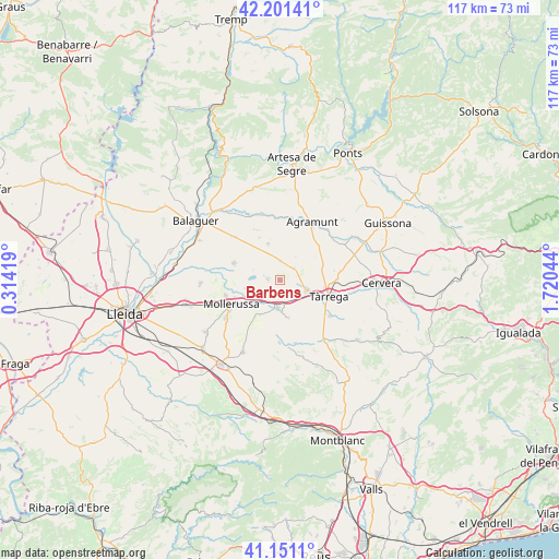
Barbens GPS coordinates[2]
41° 40' 42.24" North, 1° 1' 2.316" East
| Map corner | latitude | longitude |
|---|---|---|
| Upper-left | 42.20141°, | 0.31419° |
| Center: | 41.6784°, | 1.01731° |
| Lower-right: | 41.1511°, | 1.72044° |
| Map W x H: | 116.8×116.8 km | = 72.6×72.6mi |
| max Lat: | 43.74134° ⇑34.5% North |
| Barbens: | 41.6784° |
| min Lat: | ⇓65.5% South 27.64134° |
| min Long | Barbens | max Long |
| -18.00367° | 1.01731° | 4.2899° |
| W 90.5%⇐ | ⇒9.5% E |
Elevation
Elevation of Barbens is 282 m = 925 ft, and this is 316 m = 1037 ft below average elevation for this country.
| Max E: |
1682 m = 5518 ft | 76.2% |
| Avg. | 598 m = 1962 ft | |
| Barbens | 282 m = 925 ft | |
Min E: |
0 m = 0 ft | 23.8% |
See also: Spain elevation on elevation.city.
Geographical zone
Barbens is located in North temperate zone (between Tropic of Cancer and the Arctic Circle). Distance of this Northern Tropic circle is 2028.3 km =1260.3 mi to South.| Distance of | km | miles | from Barbens |
|---|---|---|---|
| North Pole | 5372.9 | 3338.6 | to North |
| Arctic Circle | 2767 | 1719.3 | to North |
| Tropic Cancer | 2028.3 | 1260.3 | to South |
| Equator | 4634.2 | 2879.6 | to South |


Nearby cities:
15 places around Barbens: (largest is in red/bold)
• Anglesola
6 km =3.7 mi,  114°
114°
• Bellcaire d'Urgell
11.5 km =7.1 mi,  313°
313°
• Bellpuig
5.9 km =3.7 mi,  184°
184°
• Castellnou de Seana
5.1 km =3.2 mi,  228°
228°
• Castellserà
8.1 km =5 mi,  349°
349°
• Golmés
8.7 km =5.4 mi,  235°
235°
• Ivars d'Urgell
2.5 km =1.6 mi,  274°
274°
• La Fuliola
3.9 km =2.4 mi,  0°
0°
• Linyola
8.7 km =5.4 mi,  286°
286°
• Mollerussa
11 km =6.8 mi, 242°
• Penelles
9 km =5.6 mi,  332°
332°
• Tornabous
4 km =2.5 mi,  50°
50°
• Tàrrega
10.7 km =6.6 mi, 108°
• Vilanova de Bellpuig
8.4 km =5.2 mi,  211°
211°
• el Poal
12.5 km =7.8 mi, 272°
Sources, notices
• [Note1] Compared only with cities in Spain existing in our database
• [Src1] Map data: © OpenStreetMap contributors (CC-BY-SA)
• [Src2] Other city data from geonames.org with taken over terms of usage.
• [Src3] Geographical zone / Annual Mean Temperature by Robert A. Rohde @ Wikipedia
