Albelda geodata
Albelda (Aragon) is a seat of a third-order administrative division; located in Spain in Europe/Madrid (GMT+2) time zone. With population of 877 people, there are 3087 cities with bigger population in this country. Compared to other cities in Spain, 70.1% of cities are located further ↓South; 88.8% of cities are located further ←West and 71.3% of cities have higher elevation than Albelda. Note1


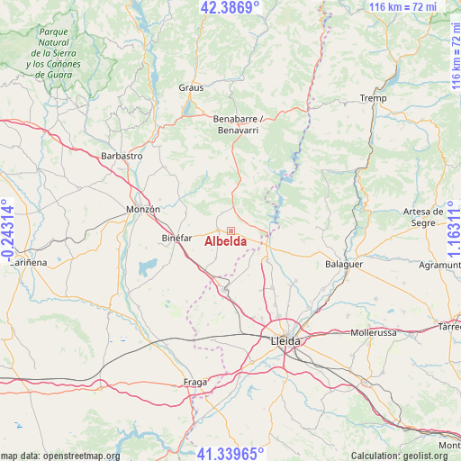
Albelda GPS coordinates[2]
41° 51' 55.512" North, 0° 27' 35.964" East
| Map corner | latitude | longitude |
|---|---|---|
| Upper-left | 42.3869°, | -0.24314° |
| Center: | 41.86542°, | 0.45999° |
| Lower-right: | 41.33965°, | 1.16311° |
| Map W x H: | 116.4×116.4 km | = 72.3×72.3mi |
| max Lat: | 43.74134° ⇑29.9% North |
| Albelda: | 41.86542° |
| min Lat: | ⇓70.1% South 27.64134° |
| min Long | Albelda | max Long |
| -18.00367° | 0.45999° | 4.2899° |
| W 88.8%⇐ | ⇒11.2% E |
Elevation
Elevation of Albelda is 362 m = 1188 ft, and this is 236 m = 774 ft below average elevation for this country.
| Max E: |
1682 m = 5518 ft | 71.3% |
| Avg. | 598 m = 1962 ft | |
| Albelda | 362 m = 1188 ft | |
Min E: |
0 m = 0 ft | 28.7% |
See also: Spain elevation on elevation.city.
Geographical zone
Albelda is located in North temperate zone (between Tropic of Cancer and the Arctic Circle). Distance of this Northern Tropic circle is 2049.1 km =1273.3 mi to South.| Distance of | km | miles | from Albelda |
|---|---|---|---|
| North Pole | 5352.1 | 3325.6 | to North |
| Arctic Circle | 2746.2 | 1706.4 | to North |
| Tropic Cancer | 2049.1 | 1273.3 | to South |
| Equator | 4655 | 2892.5 | to South |


Nearby cities:
15 places around Albelda: (largest is in red/bold)
• Albesa
20.7 km =12.9 mi,  127°
127°
• Alfarràs
11.6 km =7.2 mi,  117°
117°
• Algerri
15.7 km =9.8 mi,  111°
111°
• Alguaire
17.6 km =10.9 mi,  144°
144°
• Almacelles
14.9 km =9.3 mi,  187°
187°
• Almenar
11.8 km =7.3 mi, 130°
• Baells
9.8 km =6.1 mi,  359°
359°
• Binéfar
13.8 km =8.6 mi,  263°
263°
• Camporrells
11.5 km =7.1 mi,  26°
26°
• Esplús
17 km =10.6 mi,  244°
244°
• San Esteban de Litera (Sant Esteve de Llitera)
11.9 km =7.4 mi,  291°
291°
• Tamarit de Llitera / Tamarite de Litera
3.2 km =2 mi,  277°
277°
• Vilanova de Segrià
21 km =13 mi, 141°
• el Campell / Alcampell
5.1 km =3.2 mi,  332°
332°
• el Torricó / Altorricon
7.9 km =4.9 mi,  208°
208°
Sources, notices
• [Note1] Compared only with cities in Spain existing in our database
• [Src1] Map data: © OpenStreetMap contributors (CC-BY-SA)
• [Src2] Other city data from geonames.org with taken over terms of usage.
• [Src3] Geographical zone / Annual Mean Temperature by Robert A. Rohde @ Wikipedia
