Ábalos geodata
Ábalos (La Rioja) is a seat of a third-order administrative division; located in Spain in Europe/Madrid (GMT+2) time zone. With population of 304 people, there are 4486 cities with bigger population in this country. Compared to other cities in Spain, 88.8% of cities are located further ↓South; 58.5% of cities are located further ←West and 55.4% of cities have higher elevation than Ábalos. Note1


Ábalos GPS coordinates[2]
42° 34' 17.544" North, 2° 42' 34.416" West
| Map corner | latitude | longitude |
|---|---|---|
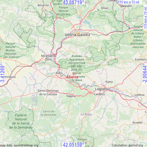
| Upper-left | 43.08719°, | -3.41269° |
| Center: | 42.57154°, | -2.70956° |
| Lower-right: | 42.05159°, | -2.00644° |
| Map W x H: | 115.1×115.1 km | = 71.5×71.5mi |
| max Lat: | 43.74134° ⇑11.2% North |
| Ábalos: | 42.57154° |
| min Lat: | ⇓88.8% South 27.64134° |
| min Long | Ábalos | max Long |
| -18.00367° | -2.70956° | 4.2899° |
| W 58.5%⇐ | ⇒41.5% E |
Elevation
Elevation of Ábalos is 590 m = 1936 ft, and this is 8 m = 26 ft below average elevation for this country.
| Max E: |
1682 m = 5518 ft | 55.4% |
| Avg. | 598 m = 1962 ft | |
| Ábalos | 590 m = 1936 ft | |
Min E: |
0 m = 0 ft | 44.6% |
See also: Spain elevation on elevation.city.
Geographical zone
Ábalos is located in North temperate zone (between Tropic of Cancer and the Arctic Circle). Distance of this Northern Tropic circle is 2127.6 km =1322 mi to South.| Distance of | km | miles | from Ábalos |
|---|---|---|---|
| North Pole | 5273.6 | 3276.9 | to North |
| Arctic Circle | 2667.7 | 1657.6 | to North |
| Tropic Cancer | 2127.6 | 1322 | to South |
| Equator | 4733.5 | 2941.3 | to South |


Nearby cities:
15 places around Ábalos: (largest is in red/bold)
• Bastida / Labastida
7.3 km =4.5 mi,  286°
286°
• Briones
7 km =4.3 mi,  243°
243°
• Briñas
10.5 km =6.5 mi, 288°
• Elciego
9.7 km =6 mi,  129°
129°
• Eskuernaga / Villabuena de Álava
4.5 km =2.8 mi, 126°
• Gimileo
9.5 km =5.9 mi,  255°
255°
• Haro
11.3 km =7 mi,  272°
272°
• Laguardia
10.4 km =6.5 mi,  100°
100°
• Leza
6.3 km =3.9 mi, 96°
• Navaridas
7.4 km =4.6 mi,  112°
112°
• Ollauri
10.7 km =6.6 mi,  252°
252°
• Samaniego
2.5 km =1.6 mi, 97°
• San Asensio
9 km =5.6 mi,  202°
202°
• San Vicente de la Sonsierra
4.3 km =2.7 mi, 257°
• Torremontalbo
8.2 km =5.1 mi,  164°
164°
Sources, notices
• [Note1] Compared only with cities in Spain existing in our database
• [Src1] Map data: © OpenStreetMap contributors (CC-BY-SA)
• [Src2] Other city data from geonames.org with taken over terms of usage.
• [Src3] Geographical zone / Annual Mean Temperature by Robert A. Rohde @ Wikipedia
