el Besòs i el Maresme geodata
el Besòs i el Maresme (Catalonia) is a section of populated place; located in Spain in Europe/Madrid (GMT+2) time zone. With population of 23,254 people, there are 401 cities with bigger population in this country. Compared to other cities in Spain, 58.2% of cities are located further ↓South; 95.4% of cities are located further ←West and 98.4% of cities have higher elevation than el Besòs i el Maresme. Note1
Administrative division(s):
- Level 1: Catalonia
- Level 2: Província de Barcelona
- Level 3: Barcelona
- Level 4: Sant Martí
Current local time in el Besòs i el Maresme:
10:51 PM, ThursdayDifference from your time zone: hours


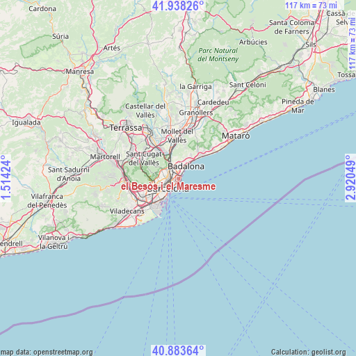
el Besòs i el Maresme GPS coordinates[2]
41° 24' 47.124" North, 2° 13' 2.496" East
| Map corner | latitude | longitude |
|---|---|---|
| Upper-left | 41.93826°, | 1.51424° |
| Center: | 41.41309°, | 2.21736° |
| Lower-right: | 40.88364°, | 2.92049° |
| Map W x H: | 117.3×117.3 km | = 72.9×72.9mi |
| max Lat: | 43.74134° ⇑41.8% North |
| el Besòs i el Maresme: | 41.41309° |
| min Lat: | ⇓58.2% South 27.64134° |
| min Long | el Besòs i el | max Long |
| -18.00367° | 2.21736° | 4.2899° |
| W 95.4%⇐ | ⇒4.6% E |
Elevation
Elevation of el Besòs i el Maresme is 10 m = 33 ft, and this is 588 m = 1929 ft below average elevation for this country.
| Max E: |
1682 m = 5518 ft | 98.4% |
| Avg. | 598 m = 1962 ft | |
| el Besòs i el Maresme | 10 m = 33 ft | |
Min E: |
0 m = 0 ft | 1.6% |
See also: Spain elevation on elevation.city.
Geographical zone
el Besòs i el Maresme is located in North temperate zone (between Tropic of Cancer and the Arctic Circle). Distance of this Northern Tropic circle is 1998.8 km =1242 mi to South.| Distance of | km | miles | from el Besòs i el Maresme |
|---|---|---|---|
| North Pole | 5402.4 | 3356.9 | to North |
| Arctic Circle | 2796.5 | 1737.7 | to North |
| Tropic Cancer | 1998.8 | 1242 | to South |
| Equator | 4604.7 | 2861.2 | to South |


Nearby cities:
15 places around el Besòs i el Maresme: (largest is in red/bold)
• Diagonal Mar
0.5 km =0.3 mi,  192°
192°
• La Sagrera
2.8 km =1.7 mi,  292°
292°
• Llefià
2.8 km =1.7 mi,  3°
3°
• Navas
2.7 km =1.7 mi,  281°
281°
• Provenals del Poblenou
1.3 km =0.8 mi,  259°
259°
• Sant Adrià de Besòs
2 km =1.2 mi, 2°
• Sant Martí
1.6 km =1 mi, 290°
• Sant Martí de Provençals
1.9 km =1.2 mi, 294°
• el Bon Pastor
3 km =1.9 mi,  334°
334°
• el Camp de l'Arpa del Clot
2.9 km =1.8 mi,  267°
267°
• el Clot
2.3 km =1.4 mi, 260°
• el Parc i la Llacuna del Poblenou
2.8 km =1.7 mi,  234°
234°
• el Poblenou
1.5 km =0.9 mi, 227°
• la Verneda i la Pau
1.7 km =1.1 mi,  315°
315°
• la Vila Olímpica del Poblenou
3 km =1.9 mi,  214°
214°
Sources, notices
• [Note1] Compared only with cities in Spain existing in our database
• [Src1] Map data: © OpenStreetMap contributors (CC-BY-SA)
• [Src2] Other city data from geonames.org with taken over terms of usage.
• [Src3] Geographical zone / Annual Mean Temperature by Robert A. Rohde @ Wikipedia
