Puente la Reina de Jaca geodata
Puente la Reina de Jaca (Aragon) is a seat of a third-order administrative division; located in Spain in Europe/Madrid (GMT+2) time zone. With population of 263 people, there are 4672 cities with bigger population in this country. Compared to other cities in Spain, 88.5% of cities are located further ↓South; 79% of cities are located further ←West and 55.2% of cities have higher elevation than Puente la Reina de Jaca. Note1
Administrative division(s):
- Level 1: Aragon
- Level 2: Provincia de Huesca
- Level 3: Puente la Reina de Jaca
Current local time in Puente la Reina de Jaca:
12:06 AM, FridayDifference from your time zone: hours


Puente la Reina de Jaca GPS coordinates[2]
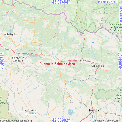
42° 33' 32.688" North, 0° 47' 15.324" West
| Map corner | latitude | longitude |
|---|---|---|
| Upper-left | 43.07484°, | -1.49071° |
| Center: | 42.55908°, | -0.78759° |
| Lower-right: | 42.03902°, | -0.08446° |
| Map W x H: | 115.2×115.2 km | = 71.6×71.6mi |
| max Lat: | 43.74134° ⇑11.5% North |
| Puente la Reina de Jaca: | 42.55908° |
| min Lat: | ⇓88.5% South 27.64134° |
| min Long | Puente la Reina | max Long |
| -18.00367° | -0.78759° | 4.2899° |
| W 79%⇐ | ⇒21% E |
Elevation
Elevation of Puente la Reina de Jaca is 593 m = 1946 ft, and this is 5 m = 16 ft below average elevation for this country.
| Max E: |
1682 m = 5518 ft | 55.2% |
| Avg. | 598 m = 1962 ft | |
| Puente la Reina de Jaca | 593 m = 1946 ft | |
Min E: |
0 m = 0 ft | 44.8% |
See also: Spain elevation on elevation.city.
Geographical zone
Puente la Reina de Jaca is located in North temperate zone (between Tropic of Cancer and the Arctic Circle). Distance of this Northern Tropic circle is 2126.2 km =1321.2 mi to South.| Distance of | km | miles | from Puente la Reina de Jaca |
|---|---|---|---|
| North Pole | 5274.9 | 3277.7 | to North |
| Arctic Circle | 2669 | 1658.4 | to North |
| Tropic Cancer | 2126.2 | 1321.2 | to South |
| Equator | 4732.1 | 2940.4 | to South |


Nearby cities:
15 places around Puente la Reina de Jaca: (largest is in red/bold)
• Aragüés del Puerto
19 km =11.8 mi,  30°
30°
• Artieda
16.4 km =10.2 mi,  280°
280°
• Bagüés
13 km =8.1 mi,  265°
265°
• Bailo
5.9 km =3.7 mi,  199°
199°
• Borau
19.7 km =12.2 mi,  55°
55°
• Castiello de Jaca
21 km =13 mi,  68°
68°
• Echo
20.2 km =12.6 mi,  8°
8°
• Fago
20.9 km =13 mi,  338°
338°
• Jaca
19.5 km =12.1 mi,  86°
86°
• Jasa
18.1 km =11.2 mi, 33°
• Lobera de Onsella
21.2 km =13.2 mi,  244°
244°
• Longás
14.8 km =9.2 mi,  234°
234°
• Mianos
14 km =8.7 mi, 282°
• Santa Cruz de la Serós
10.1 km =6.3 mi,  113°
113°
• Sigüés
20 km =12.4 mi,  293°
293°
Sources, notices
• [Note1] Compared only with cities in Spain existing in our database
• [Src1] Map data: © OpenStreetMap contributors (CC-BY-SA)
• [Src2] Other city data from geonames.org with taken over terms of usage.
• [Src3] Geographical zone / Annual Mean Temperature by Robert A. Rohde @ Wikipedia
