Tervola geodata
Tervola (Lapland) is a seat of a third-order administrative division; located in Finland in Europe/Helsinki (GMT+3) time zone. With population of 3,538 people, there are 266 cities with bigger population in this country. Compared to other cities in Finland, 96.2% of cities are located further ↓South; 51.1% of cities are located further ←West and 67.7% of cities have higher elevation than Tervola. Note1


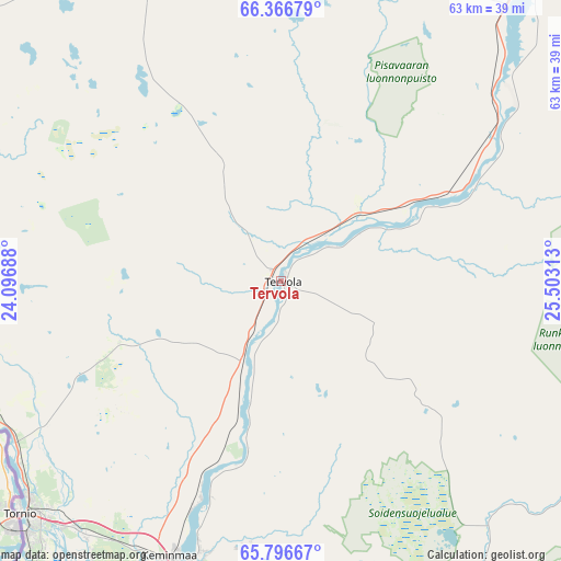
Tervola GPS coordinates[2]
66° 4' 59.988" North, 24° 48' 0" East
| Map corner | latitude | longitude |
|---|---|---|
| Upper-left | 66.36679°, | 24.09688° |
| Center: | 66.08333°, | 24.8° |
| Lower-right: | 65.79667°, | 25.50313° |
| Map W x H: | 63.4×63.4 km | = 39.4×39.4mi |
| max Lat: | 69.90864° ⇑3.8% North |
| Tervola: | 66.08333° |
| min Lat: | ⇓96.2% South 59.83333° |
| min Long | Tervola | max Long |
| 21.2° | 24.8° | 30.93276° |
| W 51.1%⇐ | ⇒48.9% E |
Elevation
Elevation of Tervola is 46 m = 151 ft, and this is 31.1 m = 102 ft below average elevation for this country.
| Max E: |
299 m = 981 ft | 67.7% |
| Avg. | 77.1 m = 253 ft | |
| Tervola | 46 m = 151 ft | |
Min E: |
1 m = 3 ft | 32.3% |
See also: Finland elevation on elevation.city.
Geographical zone
Tervola is located in North temperate zone (between Tropic of Cancer and the Arctic Circle). Distance of this North polar circle is 53.4 km =33.2 mi to North.| Distance of | km | miles | from Tervola |
|---|---|---|---|
| North Pole | 2659.3 | 1652.4 | to North |
| Arctic Circle | 53.4 | 33.2 | to North |
| Tropic Cancer | 4741.9 | 2946.5 | to South |
| Equator | 7347.8 | 4565.7 | to South |


Nearby cities:
15 places around Tervola: (largest is in red/bold)
• Hailuoto
119.5 km =74.3 mi,  181°
181°
• Haukipudas
104 km =64.6 mi,  165°
165°
• Ii
89.1 km =55.4 mi,  162°
162°
• Kemi
40 km =24.9 mi,  195°
195°
• Keminmaa
33.4 km =20.8 mi, 200°
• Kiiminki
115.3 km =71.6 mi, 156°
• Kuivaniemi
58.9 km =36.6 mi, 162°
• Oulu
123 km =76.4 mi, 165°
• Pello
85.3 km =53 mi,  334°
334°
• Ranua
80.5 km =50 mi,  103°
103°
• Rovaniemi
61.9 km =38.5 mi,  41°
41°
• Simo
47.7 km =29.6 mi, 166°
• Tornio
39.5 km =24.5 mi,  228°
228°
• Yli-Ii
92.4 km =57.4 mi,  148°
148°
• Ylitornio
56.3 km =35 mi,  296°
296°
Sources, notices
• [Note1] Compared only with cities in Finland existing in our database
• [Src1] Map data: © OpenStreetMap contributors (CC-BY-SA)
• [Src2] Other city data from geonames.org with taken over terms of usage.
• [Src3] Geographical zone / Annual Mean Temperature by Robert A. Rohde @ Wikipedia
