Pernå geodata
Pernå (Uusimaa) is a seat of a third-order administrative division; located in Finland in Europe/Helsinki (GMT+3) time zone. With population of 3,938 people, there are 249 cities with bigger population in this country. Compared to other cities in Finland, 88.5% of cities are located further ↑North; 70.7% of cities are located further ←West and 81.4% of cities have higher elevation than Pernå. Note1


Pernå GPS coordinates[2]
60° 26' 55.284" North, 26° 1' 54.732" East
| Map corner | latitude | longitude |
|---|---|---|
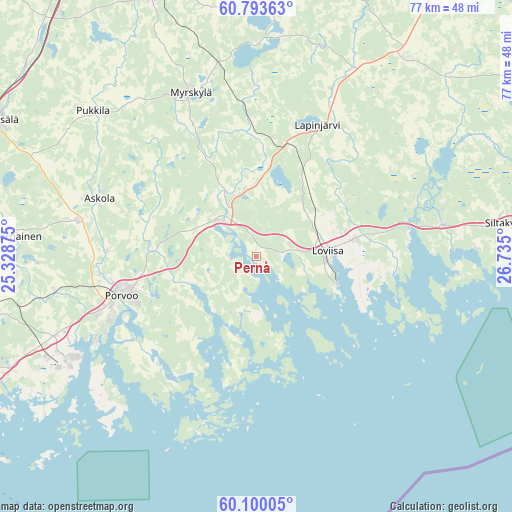
| Upper-left | 60.79363°, | 25.32875° |
| Center: | 60.44869°, | 26.03187° |
| Lower-right: | 60.10005°, | 26.735° |
| Map W x H: | 77.1×77.1 km | = 47.9×47.9mi |
| max Lat: | 69.90864° ⇑88.5% North |
| Pernå: | 60.44869° |
| min Lat: | ⇓11.5% South 59.83333° |
| min Long | Pernå | max Long |
| 21.2° | 26.03187° | 30.93276° |
| W 70.7%⇐ | ⇒29.3% E |
Elevation
Elevation of Pernå is 18 m = 59 ft, and this is 59.1 m = 194 ft below average elevation for this country.
| Max E: |
299 m = 981 ft | 81.4% |
| Avg. | 77.1 m = 253 ft | |
| Pernå | 18 m = 59 ft | |
Min E: |
1 m = 3 ft | 18.6% |
See also: Finland elevation on elevation.city.
Geographical zone
Pernå is located in North temperate zone (between Tropic of Cancer and the Arctic Circle). Distance of this North polar circle is 679.9 km =422.5 mi to North.| Distance of | km | miles | from Pernå |
|---|---|---|---|
| North Pole | 3285.8 | 2041.7 | to North |
| Arctic Circle | 679.9 | 422.5 | to North |
| Tropic Cancer | 4115.3 | 2557.1 | to South |
| Equator | 6721.3 | 4176.4 | to South |


Nearby cities:
15 places around Pernå: (largest is in red/bold)
• Artjärvi
33.1 km =20.6 mi,  3°
3°
• Askola
25.5 km =15.8 mi,  291°
291°
• Broby
38 km =23.6 mi,  81°
81°
• Elimäki
38.1 km =23.7 mi,  38°
38°
• Lapinjärvi
21.5 km =13.4 mi,  24°
24°
• Liljendal
13.9 km =8.6 mi, 4°
• Lovisa
10.6 km =6.6 mi,  85°
85°
• Myrskylä
26.6 km =16.5 mi,  337°
337°
• Nickby
41.7 km =25.9 mi,  259°
259°
• Pornainen
36.1 km =22.4 mi,  274°
274°
• Porvoo
21.1 km =13.1 mi,  252°
252°
• Pukkila
33.9 km =21.1 mi,  311°
311°
• Pyhtää
28.5 km =17.7 mi, 79°
• Ruotsinpyhtää
25.1 km =15.6 mi,  69°
69°
• Sibbo
42.6 km =26.5 mi, 259°
Sources, notices
• [Note1] Compared only with cities in Finland existing in our database
• [Src1] Map data: © OpenStreetMap contributors (CC-BY-SA)
• [Src2] Other city data from geonames.org with taken over terms of usage.
• [Src3] Geographical zone / Annual Mean Temperature by Robert A. Rohde @ Wikipedia
