Artjärvi geodata
Artjärvi (Päijänne Tavastia) is a seat of a third-order administrative division; located in Finland in Europe/Helsinki (GMT+3) time zone. With population of 1,536 people, there are 388 cities with bigger population in this country. Compared to other cities in Finland, 76.3% of cities are located further ↑North; 71.6% of cities are located further ←West and 60.5% of cities have higher elevation than Artjärvi. Note1


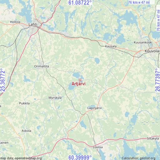
Artjärvi GPS coordinates[2]
60° 44' 43.584" North, 26° 4' 15.024" East
| Map corner | latitude | longitude |
|---|---|---|
| Upper-left | 61.08722°, | 25.36772° |
| Center: | 60.74544°, | 26.07084° |
| Lower-right: | 60.39999°, | 26.77397° |
| Map W x H: | 76.4×76.4 km | = 47.5×47.5mi |
| max Lat: | 69.90864° ⇑76.3% North |
| Artjärvi: | 60.74544° |
| min Lat: | ⇓23.7% South 59.83333° |
| min Long | Artjärvi | max Long |
| 21.2° | 26.07084° | 30.93276° |
| W 71.6%⇐ | ⇒28.4% E |
Elevation
Elevation of Artjärvi is 60 m = 197 ft, and this is 17.1 m = 56 ft below average elevation for this country.
| Max E: |
299 m = 981 ft | 60.5% |
| Avg. | 77.1 m = 253 ft | |
| Artjärvi | 60 m = 197 ft | |
Min E: |
1 m = 3 ft | 39.5% |
See also: Finland elevation on elevation.city.
Geographical zone
Artjärvi is located in North temperate zone (between Tropic of Cancer and the Arctic Circle). Distance of this North polar circle is 646.9 km =402 mi to North.| Distance of | km | miles | from Artjärvi |
|---|---|---|---|
| North Pole | 3252.8 | 2021.2 | to North |
| Arctic Circle | 646.9 | 402 | to North |
| Tropic Cancer | 4148.3 | 2577.6 | to South |
| Equator | 6754.3 | 4196.9 | to South |


Nearby cities:
15 places around Artjärvi: (largest is in red/bold)
• Askola
34.9 km =21.7 mi,  227°
227°
• Elimäki
21.8 km =13.5 mi,  98°
98°
• Iitti
22.1 km =13.7 mi,  41°
41°
• Kouvola
36.7 km =22.8 mi,  68°
68°
• Lahti
34.5 km =21.4 mi,  319°
319°
• Lapinjärvi
15.1 km =9.4 mi,  152°
152°
• Liljendal
19.1 km =11.9 mi,  182°
182°
• Lovisa
33.2 km =20.6 mi,  165°
165°
• Myrskylä
14.8 km =9.2 mi,  235°
235°
• Nastola
23.9 km =14.9 mi,  341°
341°
• Orimattila
19.7 km =12.2 mi,  289°
289°
• Pernå
33.1 km =20.6 mi, 183°
• Pukkila
29.4 km =18.3 mi,  248°
248°
• Pyhtää
38.1 km =23.7 mi,  137°
137°
• Ruotsinpyhtää
32.3 km =20.1 mi, 138°
Sources, notices
• [Note1] Compared only with cities in Finland existing in our database
• [Src1] Map data: © OpenStreetMap contributors (CC-BY-SA)
• [Src2] Other city data from geonames.org with taken over terms of usage.
• [Src3] Geographical zone / Annual Mean Temperature by Robert A. Rohde @ Wikipedia
