Perho geodata
Perho (Central Ostrobothnia) is a seat of a third-order administrative division; located in Finland in Europe/Helsinki (GMT+3) time zone. With population of 2,974 people, there are 297 cities with bigger population in this country. Compared to other cities in Finland, 75.6% of cities are located further ↓South; 55.8% of cities are located further →East and 96.2% of cities have lower elevation than Perho. Note1


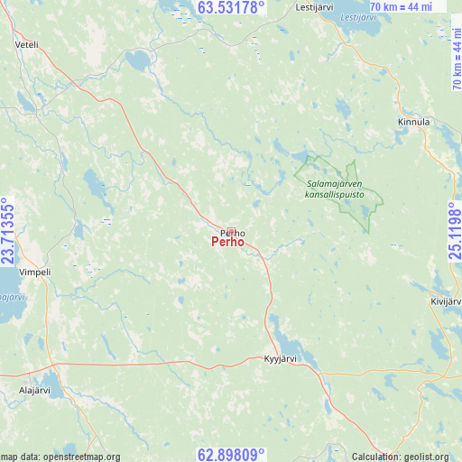
Perho GPS coordinates[2]
63° 13' 0.012" North, 24° 25' 0.012" East
| Map corner | latitude | longitude |
|---|---|---|
| Upper-left | 63.53178°, | 23.71355° |
| Center: | 63.21667°, | 24.41667° |
| Lower-right: | 62.89809°, | 25.1198° |
| Map W x H: | 70.5×70.5 km | = 43.8×43.8mi |
| max Lat: | 69.90864° ⇑24.4% North |
| Perho: | 63.21667° |
| min Lat: | ⇓75.6% South 59.83333° |
| min Long | Perho | max Long |
| 21.2° | 24.41667° | 30.93276° |
| W 44.2%⇐ | ⇒55.8% E |
Elevation
Elevation of Perho is 174 m = 571 ft, and this is 96.9 m = 318 ft above average elevation for this country.
| Max E: |
299 m = 981 ft | 3.8% |
| Perho | 174 m 571 ft | |
| Avg. | 77.1 m = 253 ft | |
Min E: |
1 m = 3 ft | 96.2% |
See also: Finland elevation on elevation.city.
Geographical zone
Perho is located in North temperate zone (between Tropic of Cancer and the Arctic Circle). Distance of this North polar circle is 372.1 km =231.2 mi to North.| Distance of | km | miles | from Perho |
|---|---|---|---|
| North Pole | 2978 | 1850.4 | to North |
| Arctic Circle | 372.1 | 231.2 | to North |
| Tropic Cancer | 4423.1 | 2748.4 | to South |
| Equator | 7029 | 4367.6 | to South |


Nearby cities:
15 places around Perho: (largest is in red/bold)
• Alajärvi
38.6 km =24 mi,  231°
231°
• Evijärvi
49.5 km =30.8 mi,  289°
289°
• Halsua
30.5 km =19 mi,  335°
335°
• Karstula
43.1 km =26.8 mi,  154°
154°
• Kinnula
32.2 km =20 mi,  58°
58°
• Kinnula
32.5 km =20.2 mi, 55°
• Kivijärvi
34.9 km =21.7 mi,  107°
107°
• Kyyjärvi
21.7 km =13.5 mi,  159°
159°
• Lappajärvi
39.3 km =24.4 mi,  267°
267°
• Lestijärvi
37.1 km =23.1 mi,  18°
18°
• Soini
40.2 km =25 mi,  194°
194°
• Ullava
45.7 km =28.4 mi, 338°
• Veteli
43 km =26.7 mi,  312°
312°
• Vimpeli
30.6 km =19 mi,  258°
258°
• Älajärvi
38.6 km =24 mi, 231°
Sources, notices
• [Note1] Compared only with cities in Finland existing in our database
• [Src1] Map data: © OpenStreetMap contributors (CC-BY-SA)
• [Src2] Other city data from geonames.org with taken over terms of usage.
• [Src3] Geographical zone / Annual Mean Temperature by Robert A. Rohde @ Wikipedia
