Lemi geodata
Lemi (South Karelia) is a seat of a third-order administrative division; located in Finland in Europe/Helsinki (GMT+3) time zone. With population of 3,034 people, there are 295 cities with bigger population in this country. Compared to other cities in Finland, 67.3% of cities are located further ↑North; 87% of cities are located further ←West and 65% of cities have lower elevation than Lemi. Note1


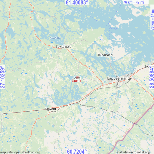
Lemi GPS coordinates[2]
61° 3' 44.784" North, 27° 48' 20.556" East
| Map corner | latitude | longitude |
|---|---|---|
| Upper-left | 61.40083°, | 27.10259° |
| Center: | 61.06244°, | 27.80571° |
| Lower-right: | 60.7204°, | 28.50884° |
| Map W x H: | 75.7×75.7 km | = 47×47mi |
| max Lat: | 69.90864° ⇑67.3% North |
| Lemi: | 61.06244° |
| min Lat: | ⇓32.7% South 59.83333° |
| min Long | Lemi | max Long |
| 21.2° | 27.80571° | 30.93276° |
| W 87%⇐ | ⇒13% E |
Elevation
Elevation of Lemi is 101 m = 331 ft, and this is 23.9 m = 78 ft above average elevation for this country.
| Max E: |
299 m = 981 ft | 35% |
| Lemi | 101 m 331 ft | |
| Avg. | 77.1 m = 253 ft | |
Min E: |
1 m = 3 ft | 65% |
See also: Finland elevation on elevation.city.
Geographical zone
Lemi is located in North temperate zone (between Tropic of Cancer and the Arctic Circle). Distance of this North polar circle is 611.7 km =380.1 mi to North.| Distance of | km | miles | from Lemi |
|---|---|---|---|
| North Pole | 3217.6 | 1999.3 | to North |
| Arctic Circle | 611.7 | 380.1 | to North |
| Tropic Cancer | 4183.6 | 2599.6 | to South |
| Equator | 6789.5 | 4218.8 | to South |


Nearby cities:
15 places around Lemi: (largest is in red/bold)
• Imatra
52.3 km =32.5 mi,  76°
76°
• Joutseno
38.2 km =23.7 mi, 80°
• Lappeenranta
20.6 km =12.8 mi,  91°
91°
• Luumäki
19.4 km =12.1 mi,  218°
218°
• Miehikkälä
44.4 km =27.6 mi,  187°
187°
• Nuijamaa
41.7 km =25.9 mi,  105°
105°
• Puumala
55.3 km =34.4 mi,  20°
20°
• Ristiina
57.6 km =35.8 mi,  328°
328°
• Ruokolahti
60.3 km =37.5 mi,  65°
65°
• Savitaipale
16.3 km =10.1 mi,  339°
339°
• Suomenniemi
35.3 km =21.9 mi, 327°
• Taavetti
20.7 km =12.9 mi, 218°
• Taipalsaari
16.3 km =10.1 mi,  53°
53°
• Virojoki
54 km =33.6 mi, 185°
• Ylämaa
31 km =19.3 mi,  160°
160°
Sources, notices
• [Note1] Compared only with cities in Finland existing in our database
• [Src1] Map data: © OpenStreetMap contributors (CC-BY-SA)
• [Src2] Other city data from geonames.org with taken over terms of usage.
• [Src3] Geographical zone / Annual Mean Temperature by Robert A. Rohde @ Wikipedia
