Lavia geodata
Lavia (Satakunta) is a populated place; located in Finland in Europe/Helsinki (GMT+3) time zone. With population of 2,109 people, there are 348 cities with bigger population in this country. Compared to other cities in Finland, 53.8% of cities are located further ↑North; 82.3% of cities are located further →East and 53.4% of cities have lower elevation than Lavia. Note1


Lavia GPS coordinates[2]
61° 36' 0" North, 22° 36' 0" East
| Map corner | latitude | longitude |
|---|---|---|
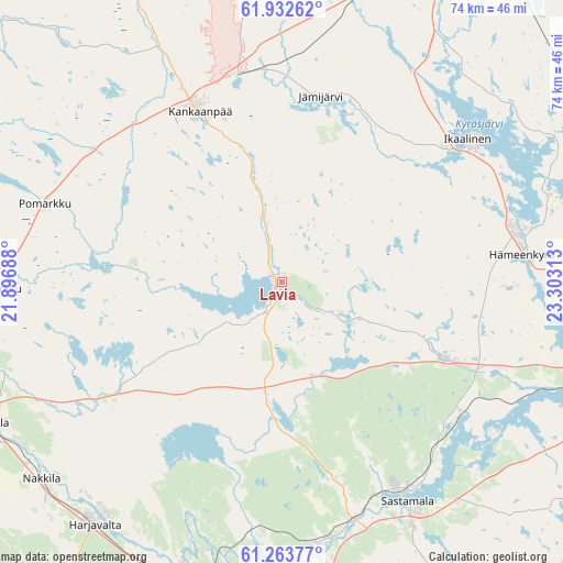
| Upper-left | 61.93262°, | 21.89688° |
| Center: | 61.6°, | 22.6° |
| Lower-right: | 61.26377°, | 23.30313° |
| Map W x H: | 74.4×74.4 km | = 46.2×46.2mi |
| max Lat: | 69.90864° ⇑53.8% North |
| Lavia: | 61.6° |
| min Lat: | ⇓46.2% South 59.83333° |
| min Long | Lavia | max Long |
| 21.2° | 22.6° | 30.93276° |
| W 17.7%⇐ | ⇒82.3% E |
Elevation
Elevation of Lavia is 85 m = 279 ft, and this is 7.9 m = 26 ft above average elevation for this country.
| Max E: |
299 m = 981 ft | 46.6% |
| Lavia | 85 m 279 ft | |
| Avg. | 77.1 m = 253 ft | |
Min E: |
1 m = 3 ft | 53.4% |
See also: Finland elevation on elevation.city.
Geographical zone
Lavia is located in North temperate zone (between Tropic of Cancer and the Arctic Circle). Distance of this North polar circle is 551.9 km =342.9 mi to North.| Distance of | km | miles | from Lavia |
|---|---|---|---|
| North Pole | 3157.8 | 1962.2 | to North |
| Arctic Circle | 551.9 | 342.9 | to North |
| Tropic Cancer | 4243.4 | 2636.7 | to South |
| Equator | 6849.3 | 4256 | to South |


Nearby cities:
15 places around Lavia: (largest is in red/bold)
• Harjavalta
40.1 km =24.9 mi,  218°
218°
• Hämeenkyrö
31.8 km =19.8 mi,  82°
82°
• Ikaalinen
31 km =19.3 mi,  52°
52°
• Jämijärvi
24.7 km =15.3 mi,  12°
12°
• Kankaanpää
24.2 km =15 mi,  336°
336°
• Kiikoinen
16.3 km =10.1 mi,  184°
184°
• Kullaa
27.4 km =17 mi,  238°
238°
• Längelmäki
27 km =16.8 mi,  281°
281°
• Mouhijärvi
24.7 km =15.3 mi,  116°
116°
• Noormarkku
38.7 km =24 mi,  268°
268°
• Pomarkku
32.9 km =20.4 mi,  288°
288°
• Suodenniemi
10.9 km =6.8 mi, 115°
• Vammala
33.7 km =20.9 mi,  151°
151°
• Viljakkala
37.1 km =23.1 mi,  71°
71°
• Äetsä
35.5 km =22.1 mi,  172°
172°
Sources, notices
• [Note1] Compared only with cities in Finland existing in our database
• [Src1] Map data: © OpenStreetMap contributors (CC-BY-SA)
• [Src2] Other city data from geonames.org with taken over terms of usage.
• [Src3] Geographical zone / Annual Mean Temperature by Robert A. Rohde @ Wikipedia
