Kurikka geodata
Kurikka (Southern Ostrobothnia) is a seat of a third-order administrative division; located in Finland in Europe/Helsinki (GMT+3) time zone. With population of 10,628 people, there are 96 cities with bigger population in this country. Compared to other cities in Finland, 63.5% of cities are located further ↓South; 84.8% of cities are located further →East and 60% of cities have higher elevation than Kurikka. Note1


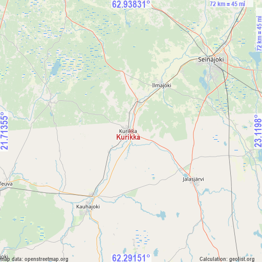
Kurikka GPS coordinates[2]
62° 37' 0.012" North, 22° 25' 0.012" East
| Map corner | latitude | longitude |
|---|---|---|
| Upper-left | 62.93831°, | 21.71355° |
| Center: | 62.61667°, | 22.41667° |
| Lower-right: | 62.29151°, | 23.1198° |
| Map W x H: | 71.9×71.9 km | = 44.7×44.7mi |
| max Lat: | 69.90864° ⇑36.5% North |
| Kurikka: | 62.61667° |
| min Lat: | ⇓63.5% South 59.83333° |
| min Long | Kurikka | max Long |
| 21.2° | 22.41667° | 30.93276° |
| W 15.2%⇐ | ⇒84.8% E |
Elevation
Elevation of Kurikka is 62 m = 203 ft, and this is 15.1 m = 50 ft below average elevation for this country.
| Max E: |
299 m = 981 ft | 60% |
| Avg. | 77.1 m = 253 ft | |
| Kurikka | 62 m = 203 ft | |
Min E: |
1 m = 3 ft | 40% |
See also: Finland elevation on elevation.city.
Geographical zone
Kurikka is located in North temperate zone (between Tropic of Cancer and the Arctic Circle). Distance of this North polar circle is 438.9 km =272.7 mi to North.| Distance of | km | miles | from Kurikka |
|---|---|---|---|
| North Pole | 3044.7 | 1891.9 | to North |
| Arctic Circle | 438.9 | 272.7 | to North |
| Tropic Cancer | 4356.4 | 2706.9 | to South |
| Equator | 6962.3 | 4326.2 | to South |


Nearby cities:
15 places around Kurikka: (largest is in red/bold)
• Ilmajoki
15.1 km =9.4 mi,  30°
30°
• Isokyrö
44.1 km =27.4 mi,  354°
354°
• Jalasjärvi
21.4 km =13.3 mi,  127°
127°
• Jurva
23.3 km =14.5 mi,  288°
288°
• Karijoki
50 km =31.1 mi,  226°
226°
• Karvia
47.9 km =29.8 mi,  165°
165°
• Karvia
54.3 km =33.7 mi, 171°
• Kauhajoki
23.6 km =14.7 mi,  210°
210°
• Laihia
45 km =28 mi,  332°
332°
• Lapua
49.4 km =30.7 mi,  37°
37°
• Nurmo
34.5 km =21.4 mi,  46°
46°
• Seinäjoki
28.8 km =17.9 mi, 46°
• Teuva
37.7 km =23.4 mi,  246°
246°
• Vähäkyrö
51.4 km =31.9 mi,  342°
342°
• Ylistaro
36.2 km =22.5 mi,  7°
7°
Sources, notices
• [Note1] Compared only with cities in Finland existing in our database
• [Src1] Map data: © OpenStreetMap contributors (CC-BY-SA)
• [Src2] Other city data from geonames.org with taken over terms of usage.
• [Src3] Geographical zone / Annual Mean Temperature by Robert A. Rohde @ Wikipedia
