Kristinestad geodata
Kristinestad (Ostrobothnia) is a seat of a third-order administrative division; located in Finland in Europe/Helsinki (GMT+3) time zone. With population of 7,712 people, there are 143 cities with bigger population in this country. Compared to other cities in Finland, 57.7% of cities are located further ↓South; 98.9% of cities are located further →East and 91.9% of cities have higher elevation than Kristinestad. Note1


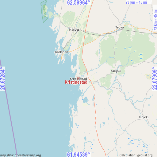
Kristinestad GPS coordinates[2]
62° 16' 27.444" North, 21° 22' 33.456" East
| Map corner | latitude | longitude |
|---|---|---|
| Upper-left | 62.59964°, | 20.67284° |
| Center: | 62.27429°, | 21.37596° |
| Lower-right: | 61.94539°, | 22.07909° |
| Map W x H: | 72.7×72.7 km | = 45.2×45.2mi |
| max Lat: | 69.90864° ⇑42.3% North |
| Kristinestad: | 62.27429° |
| min Lat: | ⇓57.7% South 59.83333° |
| min Long | Kristinestad | max Long |
| 21.2° | 21.37596° | 30.93276° |
| W 1.1%⇐ | ⇒98.9% E |
Elevation
Elevation of Kristinestad is 11 m = 36 ft, and this is 66.1 m = 217 ft below average elevation for this country.
| Max E: |
299 m = 981 ft | 91.9% |
| Avg. | 77.1 m = 253 ft | |
| Kristinestad | 11 m = 36 ft | |
Min E: |
1 m = 3 ft | 8.1% |
See also: Finland elevation on elevation.city.
Geographical zone
Kristinestad is located in North temperate zone (between Tropic of Cancer and the Arctic Circle). Distance of this North polar circle is 476.9 km =296.3 mi to North.| Distance of | km | miles | from Kristinestad |
|---|---|---|---|
| North Pole | 3082.8 | 1915.6 | to North |
| Arctic Circle | 476.9 | 296.3 | to North |
| Tropic Cancer | 4318.3 | 2683.3 | to South |
| Equator | 6924.3 | 4302.6 | to South |


Nearby cities:
15 places around Kristinestad: (largest is in red/bold)
• Honkajoki
56.5 km =35.1 mi,  124°
124°
• Isojoki
35.1 km =21.8 mi, 120°
• Jurva
55.2 km =34.3 mi,  34°
34°
• Karijoki
17.6 km =10.9 mi,  77°
77°
• Karvia
63.7 km =39.6 mi,  104°
104°
• Karvia
66.5 km =41.3 mi, 97°
• Kaskinen
14.6 km =9.1 mi,  327°
327°
• Kauhajoki
45.3 km =28.1 mi,  66°
66°
• Korsnäs
57.3 km =35.6 mi,  350°
350°
• Kurikka
65.7 km =40.8 mi,  54°
54°
• Merikarvia
46.7 km =29 mi,  172°
172°
• Närpes
22.2 km =13.8 mi, 354°
• Pomarkku
72.5 km =45 mi,  152°
152°
• Siikainen
49.8 km =30.9 mi, 152°
• Teuva
29.8 km =18.5 mi,  39°
39°
Sources, notices
• [Note1] Compared only with cities in Finland existing in our database
• [Src1] Map data: © OpenStreetMap contributors (CC-BY-SA)
• [Src2] Other city data from geonames.org with taken over terms of usage.
• [Src3] Geographical zone / Annual Mean Temperature by Robert A. Rohde @ Wikipedia
