Närpes geodata
Närpes (Ostrobothnia) is a seat of a third-order administrative division; located in Finland in Europe/Helsinki (GMT+3) time zone. In our database, there are 443 cities with bigger population. Compared to other cities in Finland, 60.7% of cities are located further ↓South; 99.6% of cities are located further →East and 87.6% of cities have higher elevation than Närpes. Note1


Närpes GPS coordinates[2]
62° 28' 22.188" North, 21° 20' 13.452" East
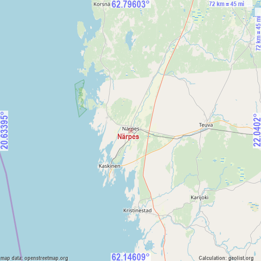
| Map corner | latitude | longitude |
|---|---|---|
| Upper-left | 62.79603°, | 20.63395° |
| Center: | 62.47283°, | 21.33707° |
| Lower-right: | 62.14609°, | 22.0402° |
| Map W x H: | 72.3×72.3 km | = 44.9×44.9mi |
| max Lat: | 69.90864° ⇑39.3% North |
| Närpes: | 62.47283° |
| min Lat: | ⇓60.7% South 59.83333° |
| min Long | Närpes | max Long |
| 21.2° | 21.33707° | 30.93276° |
| W 0.4%⇐ | ⇒99.6% E |
Elevation
Elevation of Närpes is 14 m = 46 ft, and this is 63.1 m = 207 ft below average elevation for this country.
| Max E: |
299 m = 981 ft | 87.6% |
| Avg. | 77.1 m = 253 ft | |
| Närpes | 14 m = 46 ft | |
Min E: |
1 m = 3 ft | 12.4% |
See also: Finland elevation on elevation.city.
Geographical zone
Närpes is located in North temperate zone (between Tropic of Cancer and the Arctic Circle). Distance of this North polar circle is 454.8 km =282.6 mi to North.| Distance of | km | miles | from Närpes |
|---|---|---|---|
| North Pole | 3060.7 | 1901.8 | to North |
| Arctic Circle | 454.8 | 282.6 | to North |
| Tropic Cancer | 4340.4 | 2697 | to South |
| Equator | 6946.3 | 4316.2 | to South |


Nearby cities:
15 places around Närpes: (largest is in red/bold)
• Hietalahti
69.5 km =43.2 mi,  11°
11°
• Ilmajoki
69.3 km =43.1 mi,  65°
65°
• Isojoki
51.3 km =31.9 mi,  141°
141°
• Jurva
40.5 km =25.2 mi,  54°
54°
• Karijoki
26.5 km =16.5 mi,  133°
133°
• Kaskinen
11.4 km =7.1 mi,  210°
210°
• Kauhajoki
43.7 km =27.2 mi,  95°
95°
• Korsnäs
35.2 km =21.9 mi,  348°
348°
• Kristinestad
22.2 km =13.8 mi,  174°
174°
• Kurikka
57.6 km =35.8 mi, 73°
• Laihia
65.7 km =40.8 mi,  31°
31°
• Malax
53.6 km =33.3 mi, 12°
• Merikarvia
68.8 km =42.8 mi, 172°
• Teuva
20.8 km =12.9 mi,  87°
87°
• Vaasa
70.7 km =43.9 mi, 11°
Sources, notices
• [Note1] Compared only with cities in Finland existing in our database
• [Src1] Map data: © OpenStreetMap contributors (CC-BY-SA)
• [Src2] Other city data from geonames.org with taken over terms of usage.
• [Src3] Geographical zone / Annual Mean Temperature by Robert A. Rohde @ Wikipedia
