Korppoo geodata
Korppoo (Southwest Finland) is a populated place; located in Finland in Europe/Helsinki (GMT+3) time zone. With population of 878 people, there are 432 cities with bigger population in this country. Compared to other cities in Finland, 97% of cities are located further ↑North; 97.4% of cities are located further →East and 91.9% of cities have higher elevation than Korppoo. Note1


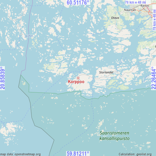
Korppoo GPS coordinates[2]
60° 9' 49.68" North, 21° 33' 41.436" East
| Map corner | latitude | longitude |
|---|---|---|
| Upper-left | 60.51176°, | 20.85839° |
| Center: | 60.1638°, | 21.56151° |
| Lower-right: | 59.81211°, | 22.26464° |
| Map W x H: | 77.8×77.8 km | = 48.3×48.3mi |
| max Lat: | 69.90864° ⇑97% North |
| Korppoo: | 60.1638° |
| min Lat: | ⇓3% South 59.83333° |
| min Long | Korppoo | max Long |
| 21.2° | 21.56151° | 30.93276° |
| W 2.6%⇐ | ⇒97.4% E |
Elevation
Elevation of Korppoo is 11 m = 36 ft, and this is 66.1 m = 217 ft below average elevation for this country.
| Max E: |
299 m = 981 ft | 91.9% |
| Avg. | 77.1 m = 253 ft | |
| Korppoo | 11 m = 36 ft | |
Min E: |
1 m = 3 ft | 8.1% |
See also: Finland elevation on elevation.city.
Geographical zone
Korppoo is located in North temperate zone (between Tropic of Cancer and the Arctic Circle). Distance of this North polar circle is 711.6 km =442.2 mi to North.| Distance of | km | miles | from Korppoo |
|---|---|---|---|
| North Pole | 3317.5 | 2061.4 | to North |
| Arctic Circle | 711.6 | 442.2 | to North |
| Tropic Cancer | 4083.7 | 2537.5 | to South |
| Equator | 6689.6 | 4156.7 | to South |


Nearby cities:
15 places around Korppoo: (largest is in red/bold)
• Askainen
47.8 km =29.7 mi,  20°
20°
• Houtskär
12.4 km =7.7 mi,  302°
302°
• Iniö
27.7 km =17.2 mi,  341°
341°
• Kustavi
43.9 km =27.3 mi,  345°
345°
• Lemu
50 km =31.1 mi,  26°
26°
• Merimasku
39.3 km =24.4 mi, 25°
• Naantali
42.3 km =26.3 mi,  37°
37°
• Nagu
19.5 km =12.1 mi,  80°
80°
• Pargas
43.8 km =27.2 mi,  68°
68°
• Raisio
49 km =30.4 mi, 43°
• Rymättylä
31.6 km =19.6 mi, 41°
• Taivassalo
44.3 km =27.5 mi,  3°
3°
• Turku
50.4 km =31.3 mi,  50°
50°
• Velkua
34.2 km =21.3 mi,  9°
9°
• Väståboland
43.5 km =27 mi, 69°
Sources, notices
• [Note1] Compared only with cities in Finland existing in our database
• [Src1] Map data: © OpenStreetMap contributors (CC-BY-SA)
• [Src2] Other city data from geonames.org with taken over terms of usage.
• [Src3] Geographical zone / Annual Mean Temperature by Robert A. Rohde @ Wikipedia
