Saint-Dizier-Leyrenne geodata
Saint-Dizier-Leyrenne (Nouvelle-Aquitaine) is a populated place; located in France in Europe/Paris (GMT+2) time zone. With population of 865 people, there are 9943 cities with bigger population in this country. Compared to other cities in France, 65.9% of cities are located further ↑North; 60.3% of cities are located further →East and 90.4% of cities have lower elevation than Saint-Dizier-Leyrenne. Note1
Administrative division(s):
- Level 1: Nouvelle-Aquitaine
- Level 2: Creuse
- Level 3: Arrondissement de Guéret
- Level 4: Saint-Dizier-Masbaraud
Current local time in Saint-Dizier-Leyrenne:
01:40 PM, WednesdayDifference from your time zone: hours


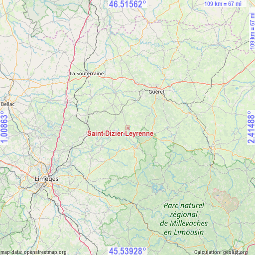
Saint-Dizier-Leyrenne GPS coordinates[2]
46° 1' 46.596" North, 1° 42' 42.3" East
| Map corner | latitude | longitude |
|---|---|---|
| Upper-left | 46.51562°, | 1.00863° |
| Center: | 46.02961°, | 1.71175° |
| Lower-right: | 45.53928°, | 2.41488° |
| Map W x H: | 108.6×108.6 km | = 67.5×67.5mi |
| max Lat: | 51.07786° ⇑65.9% North |
| Saint-Dizier-Leyrenne: | 46.02961° |
| min Lat: | ⇓34.1% South 41.3874° |
| min Long | Saint-Dizier-Le | max Long |
| -5.08615° | 1.71175° | 9.52242° |
| W 39.7%⇐ | ⇒60.3% E |
Elevation
Elevation of Saint-Dizier-Leyrenne is 436 m = 1430 ft, and this is 242.3 m = 795 ft above average elevation for this country.
| Max E: |
2333 m = 7654 ft | 9.6% |
| Saint-Dizier-Leyrenne | 436 m 1430 ft | |
| Avg. | 193.7 m = 635 ft | |
Min E: |
-1 m = -3 ft | 90.4% |
See also: France elevation on elevation.city.
Geographical zone
Saint-Dizier-Leyrenne is located in North temperate zone (between Tropic of Cancer and the Arctic Circle). Distance of this North polar circle is 2283.2 km =1418.7 mi to North.| Distance of | km | miles | from Saint-Dizier-Leyrenne |
|---|---|---|---|
| North Pole | 4889 | 3037.9 | to North |
| Arctic Circle | 2283.2 | 1418.7 | to North |
| Tropic Cancer | 2512.1 | 1560.9 | to South |
| Equator | 5118 | 3180.2 | to South |


Nearby cities:
15 places around Saint-Dizier-Leyrenne: (largest is in red/bold)
• Bourganeuf
9.1 km =5.7 mi,  158°
158°
• Bénévent-l’Abbaye
11.8 km =7.3 mi,  326°
326°
• Guéret
20.1 km =12.5 mi,  37°
37°
• La Jonchère-Saint-Maurice
19.2 km =11.9 mi,  259°
259°
• Laurière
19 km =11.8 mi,  285°
285°
• Le Grand-Bourg
15.4 km =9.6 mi,  340°
340°
• Marsac
12.3 km =7.6 mi,  308°
308°
• Mourioux-Vieilleville
7.6 km =4.7 mi,  321°
321°
• Saint-Laurent-les-Églises
18.8 km =11.7 mi,  241°
241°
• Saint-Sulpice-Laurière
18.8 km =11.7 mi,  277°
277°
• Saint-Vaury
19.7 km =12.2 mi,  9°
9°
• Saint-Étienne-de-Fursac
19.9 km =12.4 mi, 309°
• Sainte-Feyre
19.9 km =12.4 mi,  52°
52°
• Sardent
11.4 km =7.1 mi,  78°
78°
• Sauviat-sur-Vige
15.9 km =9.9 mi,  210°
210°
Sources, notices
• [Note1] Compared only with cities in France existing in our database
• [Src1] Map data: © OpenStreetMap contributors (CC-BY-SA)
• [Src2] Other city data from geonames.org with taken over terms of usage.
• [Src3] Geographical zone / Annual Mean Temperature by Robert A. Rohde @ Wikipedia
