Gunsbach geodata
Gunsbach (Grand Est) is a populated place; located in France in Europe/Paris (GMT+2) time zone. With population of 829 people, there are 10301 cities with bigger population in this country. Compared to other cities in France, 60.2% of cities are located further ↓South; 95.6% of cities are located further ←West and 83.6% of cities have lower elevation than Gunsbach. Note1
Administrative division(s):
- Level 1: Grand Est
- Level 2: Haut-Rhin
- Level 3: Arrondissement de Colmar-Ribeauvillé
- Level 4: Gunsbach


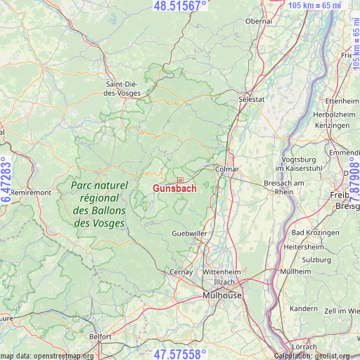
Gunsbach GPS coordinates[2]
48° 2' 51.972" North, 7° 10' 33.42" East
| Map corner | latitude | longitude |
|---|---|---|
| Upper-left | 48.51567°, | 6.47283° |
| Center: | 48.04777°, | 7.17595° |
| Lower-right: | 47.57558°, | 7.87908° |
| Map W x H: | 104.5×104.5 km | = 64.9×64.9mi |
| max Lat: | 51.07786° ⇑39.8% North |
| Gunsbach: | 48.04777° |
| min Lat: | ⇓60.2% South 41.3874° |
| min Long | Gunsbach | max Long |
| -5.08615° | 7.17595° | 9.52242° |
| W 95.6%⇐ | ⇒4.4% E |
Elevation
Elevation of Gunsbach is 330 m = 1083 ft, and this is 136.3 m = 447 ft above average elevation for this country.
| Max E: |
2333 m = 7654 ft | 16.4% |
| Gunsbach | 330 m 1083 ft | |
| Avg. | 193.7 m = 635 ft | |
Min E: |
-1 m = -3 ft | 83.6% |
See also: France elevation on elevation.city.
Geographical zone
Gunsbach is located in North temperate zone (between Tropic of Cancer and the Arctic Circle). Distance of this North polar circle is 2058.8 km =1279.3 mi to North.| Distance of | km | miles | from Gunsbach |
|---|---|---|---|
| North Pole | 4664.7 | 2898.5 | to North |
| Arctic Circle | 2058.8 | 1279.3 | to North |
| Tropic Cancer | 2736.5 | 1700.4 | to South |
| Equator | 5342.4 | 3319.6 | to South |


Nearby cities:
15 places around Gunsbach: (largest is in red/bold)
• Breitenbach-Haut-Rhin
6.1 km =3.8 mi,  243°
243°
• Griesbach-au-Val
1.3 km =0.8 mi,  189°
189°
• Labaroche
7.1 km =4.4 mi,  9°
9°
• Luttenbach-près-Munster
4.7 km =2.9 mi,  247°
247°
• Muhlbach-sur-Munster
7.4 km =4.6 mi, 250°
• Munster
2.8 km =1.7 mi, 253°
• Osenbach
7.6 km =4.7 mi,  155°
155°
• Soultzbach-les-Bains
2.4 km =1.5 mi,  118°
118°
• Soultzeren
5.8 km =3.6 mi,  288°
288°
• Stosswihr
5.7 km =3.5 mi,  276°
276°
• Turckheim
8.7 km =5.4 mi,  59°
59°
• Vœgtlinshoffen
8.4 km =5.2 mi,  111°
111°
• Walbach
3.9 km =2.4 mi, 64°
• Wihr-au-Val
2.2 km =1.4 mi,  77°
77°
• Zimmerbach
5.3 km =3.3 mi, 57°
Sources, notices
• [Note1] Compared only with cities in France existing in our database
• [Src1] Map data: © OpenStreetMap contributors (CC-BY-SA)
• [Src2] Other city data from geonames.org with taken over terms of usage.
• [Src3] Geographical zone / Annual Mean Temperature by Robert A. Rohde @ Wikipedia
