Wihr-au-Val geodata
Wihr-au-Val (Grand Est) is a populated place; located in France in Europe/Paris (GMT+2) time zone. With population of 1,297 people, there are 7046 cities with bigger population in this country. Compared to other cities in France, 60.2% of cities are located further ↓South; 95.8% of cities are located further ←West and 81.6% of cities have lower elevation than Wihr-au-Val. Note1
Administrative division(s):
- Level 1: Grand Est
- Level 2: Haut-Rhin
- Level 3: Arrondissement de Colmar-Ribeauvillé
- Level 4: Wihr-au-Val


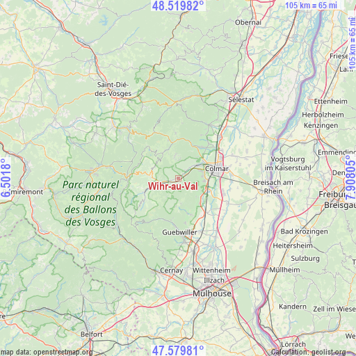
Wihr-au-Val GPS coordinates[2]
48° 3' 7.056" North, 7° 12' 17.748" East
| Map corner | latitude | longitude |
|---|---|---|
| Upper-left | 48.51982°, | 6.5018° |
| Center: | 48.05196°, | 7.20493° |
| Lower-right: | 47.57981°, | 7.90805° |
| Map W x H: | 104.5×104.5 km | = 64.9×64.9mi |
| max Lat: | 51.07786° ⇑39.8% North |
| Wihr-au-Val: | 48.05196° |
| min Lat: | ⇓60.2% South 41.3874° |
| min Long | Wihr-au-Val | max Long |
| -5.08615° | 7.20493° | 9.52242° |
| W 95.8%⇐ | ⇒4.2% E |
Elevation
Elevation of Wihr-au-Val is 306 m = 1004 ft, and this is 112.3 m = 368 ft above average elevation for this country.
| Max E: |
2333 m = 7654 ft | 18.4% |
| Wihr-au-Val | 306 m 1004 ft | |
| Avg. | 193.7 m = 635 ft | |
Min E: |
-1 m = -3 ft | 81.6% |
See also: France elevation on elevation.city.
Geographical zone
Wihr-au-Val is located in North temperate zone (between Tropic of Cancer and the Arctic Circle). Distance of this North polar circle is 2058.3 km =1279 mi to North.| Distance of | km | miles | from Wihr-au-Val |
|---|---|---|---|
| North Pole | 4664.2 | 2898.2 | to North |
| Arctic Circle | 2058.3 | 1279 | to North |
| Tropic Cancer | 2737 | 1700.7 | to South |
| Equator | 5342.9 | 3319.9 | to South |


Nearby cities:
15 places around Wihr-au-Val: (largest is in red/bold)
• Griesbach-au-Val
3 km =1.9 mi,  233°
233°
• Gueberschwihr
7.5 km =4.7 mi,  135°
135°
• Gunsbach
2.2 km =1.4 mi,  257°
257°
• Labaroche
6.6 km =4.1 mi,  351°
351°
• Luttenbach-près-Munster
6.9 km =4.3 mi,  250°
250°
• Munster
5 km =3.1 mi, 255°
• Niedermorschwihr
7.4 km =4.6 mi,  43°
43°
• Osenbach
7.4 km =4.6 mi,  172°
172°
• Soultzbach-les-Bains
1.6 km =1 mi,  181°
181°
• Turckheim
6.7 km =4.2 mi,  53°
53°
• Vœgtlinshoffen
6.7 km =4.2 mi,  121°
121°
• Walbach
1.8 km =1.1 mi, 47°
• Wettolsheim
7 km =4.3 mi,  84°
84°
• Wintzenheim
6.8 km =4.2 mi,  70°
70°
• Zimmerbach
3.3 km =2.1 mi, 43°
Sources, notices
• [Note1] Compared only with cities in France existing in our database
• [Src1] Map data: © OpenStreetMap contributors (CC-BY-SA)
• [Src2] Other city data from geonames.org with taken over terms of usage.
• [Src3] Geographical zone / Annual Mean Temperature by Robert A. Rohde @ Wikipedia
