Ymeray geodata
Ymeray (Centre) is a populated place; located in France in Europe/Paris (GMT+2) time zone. With population of 574 people, there are 13763 cities with bigger population in this country. Compared to other cities in France, 68.5% of cities are located further ↓South; 60.5% of cities are located further →East and 53.8% of cities have higher elevation than Ymeray. Note1
Administrative division(s):
- Level 1: Centre
- Level 2: Département d'Eure-et-Loir
- Level 3: Arrondissement de Chartres
- Level 4: Ymeray


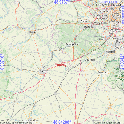
Ymeray GPS coordinates[2]
48° 30' 36.108" North, 1° 42' 1.044" East
| Map corner | latitude | longitude |
|---|---|---|
| Upper-left | 48.9737°, | 0.99716° |
| Center: | 48.51003°, | 1.70029° |
| Lower-right: | 48.04208°, | 2.40342° |
| Map W x H: | 103.6×103.6 km | = 64.4×64.4mi |
| max Lat: | 51.07786° ⇑31.5% North |
| Ymeray: | 48.51003° |
| min Lat: | ⇓68.5% South 41.3874° |
| min Long | Ymeray | max Long |
| -5.08615° | 1.70029° | 9.52242° |
| W 39.5%⇐ | ⇒60.5% E |
Elevation
Elevation of Ymeray is 120 m = 394 ft, and this is 73.7 m = 242 ft below average elevation for this country.
| Max E: |
2333 m = 7654 ft | 53.8% |
| Avg. | 193.7 m = 635 ft | |
| Ymeray | 120 m = 394 ft | |
Min E: |
-1 m = -3 ft | 46.2% |
See also: France elevation on elevation.city.
Geographical zone
Ymeray is located in North temperate zone (between Tropic of Cancer and the Arctic Circle). Distance of this North polar circle is 2007.4 km =1247.3 mi to North.| Distance of | km | miles | from Ymeray |
|---|---|---|---|
| North Pole | 4613.3 | 2866.6 | to North |
| Arctic Circle | 2007.4 | 1247.3 | to North |
| Tropic Cancer | 2787.9 | 1732.3 | to South |
| Equator | 5393.8 | 3351.6 | to South |


Nearby cities:
15 places around Ymeray: (largest is in red/bold)
• Armenonville-les-Gâtineaux
5.4 km =3.4 mi,  313°
313°
• Auneau
7.4 km =4.6 mi,  134°
134°
• Béville-le-Comte
8.3 km =5.2 mi,  173°
173°
• Coltainville
8.7 km =5.4 mi,  253°
253°
• Gallardon
1.9 km =1.2 mi,  343°
343°
• Gas
6.8 km =4.2 mi, 338°
• Houx
8.7 km =5.4 mi,  316°
316°
• Le Gué-de-Longroi
1.7 km =1.1 mi,  124°
124°
• Mévoisins
9.1 km =5.7 mi,  300°
300°
• Orphin
9.6 km =6 mi,  37°
37°
• Saint-Piat
9.5 km =5.9 mi, 295°
• Saint-Symphorien-le-Château
4.6 km =2.9 mi,  79°
79°
• Yermenonville
7.9 km =4.9 mi, 311°
• Écrosnes
4.6 km =2.9 mi,  27°
27°
• Émancé
9.2 km =5.7 mi,  14°
14°
Sources, notices
• [Note1] Compared only with cities in France existing in our database
• [Src1] Map data: © OpenStreetMap contributors (CC-BY-SA)
• [Src2] Other city data from geonames.org with taken over terms of usage.
• [Src3] Geographical zone / Annual Mean Temperature by Robert A. Rohde @ Wikipedia
