Keskastel geodata
Keskastel (Grand Est) is a populated place; located in France in Europe/Paris (GMT+2) time zone. With population of 1,527 people, there are 6097 cities with bigger population in this country. Compared to other cities in France, 79% of cities are located further ↓South; 95% of cities are located further ←West and 69.2% of cities have lower elevation than Keskastel. Note1
Administrative division(s):
- Level 1: Grand Est
- Level 2: Bas-Rhin
- Level 3: Arrondissement de Saverne
- Level 4: Keskastel


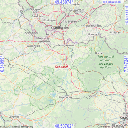
Keskastel GPS coordinates[2]
48° 58' 16.752" North, 7° 2' 38.832" East
| Map corner | latitude | longitude |
|---|---|---|
| Upper-left | 49.43074°, | 6.34099° |
| Center: | 48.97132°, | 7.04412° |
| Lower-right: | 48.50762°, | 7.74724° |
| Map W x H: | 102.6×102.6 km | = 63.8×63.8mi |
| max Lat: | 51.07786° ⇑21% North |
| Keskastel: | 48.97132° |
| min Lat: | ⇓79% South 41.3874° |
| min Long | Keskastel | max Long |
| -5.08615° | 7.04412° | 9.52242° |
| W 95%⇐ | ⇒5% E |
Elevation
Elevation of Keskastel is 215 m = 705 ft, and this is 21.3 m = 70 ft above average elevation for this country.
| Max E: |
2333 m = 7654 ft | 30.8% |
| Keskastel | 215 m 705 ft | |
| Avg. | 193.7 m = 635 ft | |
Min E: |
-1 m = -3 ft | 69.2% |
See also: France elevation on elevation.city.
Geographical zone
Keskastel is located in North temperate zone (between Tropic of Cancer and the Arctic Circle). Distance of this North polar circle is 1956.1 km =1215.5 mi to North.| Distance of | km | miles | from Keskastel |
|---|---|---|---|
| North Pole | 4562 | 2834.7 | to North |
| Arctic Circle | 1956.1 | 1215.5 | to North |
| Tropic Cancer | 2839.2 | 1764.2 | to South |
| Equator | 5445.1 | 3383.4 | to South |


Nearby cities:
15 places around Keskastel: (largest is in red/bold)
• Grundviller
9.6 km =6 mi,  327°
327°
• Hambach
9.8 km =6.1 mi,  356°
356°
• Harskirchen
4.2 km =2.6 mi,  187°
187°
• Herbitzheim
5.6 km =3.5 mi,  29°
29°
• Hilsprich
10.5 km =6.5 mi,  296°
296°
• Holving
7.3 km =4.5 mi,  308°
308°
• Kalhausen
9.8 km =6.1 mi,  54°
54°
• Le Val-de-Guéblange
6 km =3.7 mi,  280°
280°
• Oermingen
7 km =4.3 mi,  62°
62°
• Rémering-lès-Puttelange
10.6 km =6.6 mi, 313°
• Sarralbe
3.2 km =2 mi,  342°
342°
• Sarre-Union
5.2 km =3.2 mi,  135°
135°
• Sarrewerden
6.2 km =3.9 mi,  151°
151°
• Siltzheim
10.9 km =6.8 mi,  19°
19°
• Willerwald
6 km =3.7 mi, 355°
Sources, notices
• [Note1] Compared only with cities in France existing in our database
• [Src1] Map data: © OpenStreetMap contributors (CC-BY-SA)
• [Src2] Other city data from geonames.org with taken over terms of usage.
• [Src3] Geographical zone / Annual Mean Temperature by Robert A. Rohde @ Wikipedia
