Rémering-lès-Puttelange geodata
Rémering-lès-Puttelange (Grand Est) is a populated place; located in France in Europe/Paris (GMT+2) time zone. With population of 868 people, there are 9914 cities with bigger population in this country. Compared to other cities in France, 80.5% of cities are located further ↓South; 94.5% of cities are located further ←West and 71.6% of cities have lower elevation than Rémering-lès-Puttelange. Note1
Administrative division(s):
- Level 1: Grand Est
- Level 2: Moselle
- Level 3: Arrondissement de Sarreguemines
- Level 4: Rémering-lès-Puttelange
Current local time in Rémering-lès-Puttelange:
08:13 PM, FridayDifference from your time zone: hours


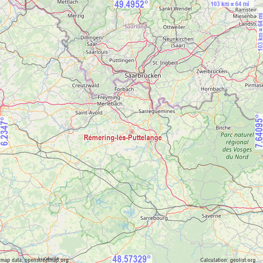
Rémering-lès-Puttelange GPS coordinates[2]
49° 2' 10.968" North, 6° 56' 16.188" East
| Map corner | latitude | longitude |
|---|---|---|
| Upper-left | 49.4952°, | 6.2347° |
| Center: | 49.03638°, | 6.93783° |
| Lower-right: | 48.57329°, | 7.64095° |
| Map W x H: | 102.5×102.5 km | = 63.7×63.7mi |
| max Lat: | 51.07786° ⇑19.5% North |
| Rémering-lès-Puttelange: | 49.03638° |
| min Lat: | ⇓80.5% South 41.3874° |
| min Long | Rémering-lès- | max Long |
| -5.08615° | 6.93783° | 9.52242° |
| W 94.5%⇐ | ⇒5.5% E |
Elevation
Elevation of Rémering-lès-Puttelange is 227 m = 745 ft, and this is 33.3 m = 109 ft above average elevation for this country.
| Max E: |
2333 m = 7654 ft | 28.4% |
| Rémering-lès-Puttelange | 227 m 745 ft | |
| Avg. | 193.7 m = 635 ft | |
Min E: |
-1 m = -3 ft | 71.6% |
See also: France elevation on elevation.city.
Geographical zone
Rémering-lès-Puttelange is located in North temperate zone (between Tropic of Cancer and the Arctic Circle). Distance of this North polar circle is 1948.8 km =1210.9 mi to North.| Distance of | km | miles | from Rémering-lès-Puttelange |
|---|---|---|---|
| North Pole | 4554.7 | 2830.2 | to North |
| Arctic Circle | 1948.8 | 1210.9 | to North |
| Tropic Cancer | 2846.4 | 1768.7 | to South |
| Equator | 5452.3 | 3387.9 | to South |


Nearby cities:
15 places around Rémering-lès-Puttelange: (largest is in red/bold)
• Cappel
7.7 km =4.8 mi,  301°
301°
• Diebling
8.1 km =5 mi,  0°
0°
• Ernestviller
4.1 km =2.5 mi,  29°
29°
• Farschviller
7.1 km =4.4 mi,  334°
334°
• Grundviller
2.7 km =1.7 mi,  70°
70°
• Hambach
7.6 km =4.7 mi, 70°
• Hilsprich
3 km =1.9 mi,  213°
213°
• Holving
3.4 km =2.1 mi,  143°
143°
• Le Val-de-Guéblange
6.4 km =4 mi,  163°
163°
• Loupershouse
5.2 km =3.2 mi,  340°
340°
• Metzing
7.8 km =4.8 mi,  10°
10°
• Saint-Jean-Rohrbach
4.1 km =2.5 mi,  253°
253°
• Sarralbe
8 km =5 mi,  121°
121°
• Willerwald
7.4 km =4.6 mi,  100°
100°
• Woustviller
6.6 km =4.1 mi,  47°
47°
Sources, notices
• [Note1] Compared only with cities in France existing in our database
• [Src1] Map data: © OpenStreetMap contributors (CC-BY-SA)
• [Src2] Other city data from geonames.org with taken over terms of usage.
• [Src3] Geographical zone / Annual Mean Temperature by Robert A. Rohde @ Wikipedia
