Luttenbach-près-Munster geodata
Luttenbach-près-Munster (Grand Est) is a populated place; located in France in Europe/Paris (GMT+1) time zone. With population of 842 people, there are 10164 cities with bigger population in this country. Compared to other cities in France, 59.8% of cities are located further ↓South; 95.4% of cities are located further ←West and 88.8% of cities have lower elevation than Luttenbach-près-Munster. Note1
Administrative division(s):
- Level 1: Grand Est
- Level 2: Haut-Rhin
- Level 3: Arrondissement de Colmar-Ribeauvillé
- Level 4: Luttenbach-près-Munster
Current local time in Luttenbach-près-Munster:
05:47 AM, TuesdayDifference from your time zone: hours


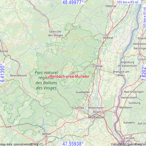
Luttenbach-près-Munster GPS coordinates[2]
48° 1' 54.192" North, 7° 7' 1.452" East
| Map corner | latitude | longitude |
|---|---|---|
| Upper-left | 48.49977°, | 6.41395° |
| Center: | 48.03172°, | 7.11707° |
| Lower-right: | 47.55938°, | 7.8202° |
| Map W x H: | 104.6×104.6 km | = 65×65mi |
| max Lat: | 51.07786° ⇑40.2% North |
| Luttenbach-près-Munster: | 48.03172° |
| min Lat: | ⇓59.8% South 41.3874° |
| min Long | Luttenbach-prè | max Long |
| -5.08615° | 7.11707° | 9.52242° |
| W 95.4%⇐ | ⇒4.6% E |
Elevation
Elevation of Luttenbach-près-Munster is 404 m = 1325 ft, and this is 210.3 m = 690 ft above average elevation for this country.
| Max E: |
2333 m = 7654 ft | 11.2% |
| Luttenbach-près-Munster | 404 m 1325 ft | |
| Avg. | 193.7 m = 635 ft | |
Min E: |
-1 m = -3 ft | 88.8% |
See also: France elevation on elevation.city.
Geographical zone
Luttenbach-près-Munster is located in North temperate zone (between Tropic of Cancer and the Arctic Circle). Distance of this North polar circle is 2060.5 km =1280.3 mi to North.| Distance of | km | miles | from Luttenbach-près-Munster |
|---|---|---|---|
| North Pole | 4666.4 | 2899.6 | to North |
| Arctic Circle | 2060.5 | 1280.3 | to North |
| Tropic Cancer | 2734.7 | 1699.3 | to South |
| Equator | 5340.6 | 3318.5 | to South |


Nearby cities:
15 places around Luttenbach-près-Munster: (largest is in red/bold)
• Breitenbach-Haut-Rhin
1.5 km =0.9 mi,  230°
230°
• Griesbach-au-Val
4.2 km =2.6 mi,  83°
83°
• Gunsbach
4.7 km =2.9 mi,  67°
67°
• Linthal
8.8 km =5.5 mi,  176°
176°
• Metzeral
4.1 km =2.5 mi,  237°
237°
• Muhlbach-sur-Munster
2.7 km =1.7 mi,  254°
254°
• Munster
1.9 km =1.2 mi,  59°
59°
• Osenbach
9.1 km =5.7 mi,  124°
124°
• Sondernach
4.9 km =3 mi,  220°
220°
• Soultzbach-les-Bains
6.5 km =4 mi, 84°
• Soultzeren
3.7 km =2.3 mi,  342°
342°
• Stosswihr
2.8 km =1.7 mi,  332°
332°
• Walbach
8.6 km =5.3 mi, 66°
• Wihr-au-Val
6.9 km =4.3 mi, 70°
• Zimmerbach
10 km =6.2 mi, 62°
Sources, notices
• [Note1] Compared only with cities in France existing in our database
• [Src1] Map data: © OpenStreetMap contributors (CC-BY-SA)
• [Src2] Other city data from geonames.org with taken over terms of usage.
• [Src3] Geographical zone / Annual Mean Temperature by Robert A. Rohde @ Wikipedia
