Wavrechain-sous-Denain geodata
Wavrechain-sous-Denain (Hauts-de-France) is a populated place; located in France in Europe/Paris (GMT+2) time zone. With population of 1,769 people, there are 5361 cities with bigger population in this country. Compared to other cities in France, 95.9% of cities are located further ↓South; 63.3% of cities are located further ←West and 88.6% of cities have higher elevation than Wavrechain-sous-Denain. Note1
Administrative division(s):
- Level 1: Hauts-de-France
- Level 2: Nord
- Level 3: Arrondissement de Valenciennes
- Level 4: Wavrechain-sous-Denain


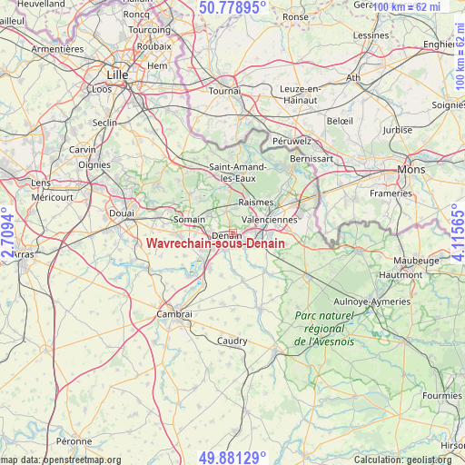
Wavrechain-sous-Denain GPS coordinates[2]
50° 19' 56.064" North, 3° 24' 45.072" East
| Map corner | latitude | longitude |
|---|---|---|
| Upper-left | 50.77895°, | 2.7094° |
| Center: | 50.33224°, | 3.41252° |
| Lower-right: | 49.88129°, | 4.11565° |
| Map W x H: | 99.8×99.8 km | = 62×62mi |
| max Lat: | 51.07786° ⇑4.1% North |
| Wavrechain-sous-Denain: | 50.33224° |
| min Lat: | ⇓95.9% South 41.3874° |
| min Long | Wavrechain-sous | max Long |
| -5.08615° | 3.41252° | 9.52242° |
| W 63.3%⇐ | ⇒36.7% E |
Elevation
Elevation of Wavrechain-sous-Denain is 33 m = 108 ft, and this is 160.7 m = 527 ft below average elevation for this country.
| Max E: |
2333 m = 7654 ft | 88.6% |
| Avg. | 193.7 m = 635 ft | |
| Wavrechain-sous-Denain | 33 m = 108 ft | |
Min E: |
-1 m = -3 ft | 11.4% |
See also: France elevation on elevation.city.
Geographical zone
Wavrechain-sous-Denain is located in North temperate zone (between Tropic of Cancer and the Arctic Circle). Distance of this North polar circle is 1804.8 km =1121.5 mi to North.| Distance of | km | miles | from Wavrechain-sous-Denain |
|---|---|---|---|
| North Pole | 4410.6 | 2740.6 | to North |
| Arctic Circle | 1804.8 | 1121.5 | to North |
| Tropic Cancer | 2990.5 | 1858.2 | to South |
| Equator | 5596.4 | 3477.4 | to South |


Nearby cities:
15 places around Wavrechain-sous-Denain: (largest is in red/bold)
• Aubry-du-Hainaut
5.4 km =3.4 mi,  45°
45°
• Bellaing
4.1 km =2.5 mi,  12°
12°
• Denain
1.3 km =0.8 mi,  255°
255°
• Douchy-les-Mines
3.8 km =2.4 mi,  201°
201°
• Escaudain
4.8 km =3 mi,  271°
271°
• Haulchin
2.4 km =1.5 mi,  135°
135°
• Haveluy
2.4 km =1.5 mi,  345°
345°
• Hérin
3.9 km =2.4 mi, 47°
• La Sentinelle
5.5 km =3.4 mi,  67°
67°
• Lourches
4.7 km =2.9 mi,  243°
243°
• Prouvy
3.2 km =2 mi,  120°
120°
• Rouvignies
2.7 km =1.7 mi,  112°
112°
• Thiant
4 km =2.5 mi, 140°
• Trith-Saint-Léger
5.3 km =3.3 mi, 109°
• Wallers
4.9 km =3 mi,  342°
342°
Sources, notices
• [Note1] Compared only with cities in France existing in our database
• [Src1] Map data: © OpenStreetMap contributors (CC-BY-SA)
• [Src2] Other city data from geonames.org with taken over terms of usage.
• [Src3] Geographical zone / Annual Mean Temperature by Robert A. Rohde @ Wikipedia
