Haveluy geodata
Haveluy (Hauts-de-France) is a populated place; located in France in Europe/Paris (GMT+2) time zone. With population of 3,136 people, there are 3106 cities with bigger population in this country. Compared to other cities in France, 96% of cities are located further ↓South; 63.3% of cities are located further ←West and 90.3% of cities have higher elevation than Haveluy. Note1
Administrative division(s):
- Level 1: Hauts-de-France
- Level 2: Nord
- Level 3: Arrondissement de Valenciennes
- Level 4: Haveluy


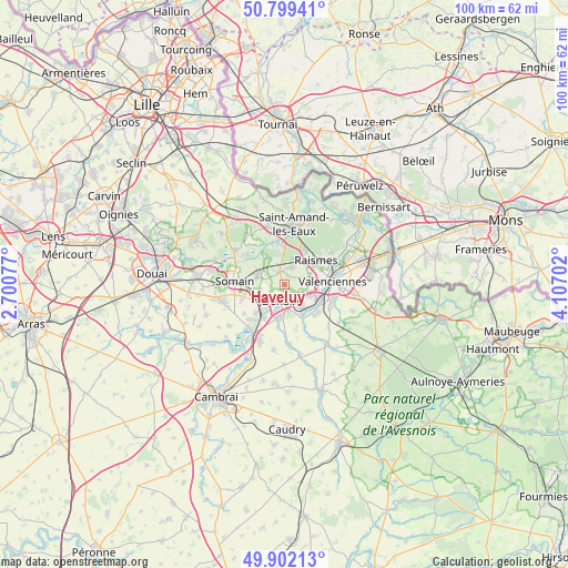
Haveluy GPS coordinates[2]
50° 21' 10.404" North, 3° 24' 14.004" East
| Map corner | latitude | longitude |
|---|---|---|
| Upper-left | 50.79941°, | 2.70077° |
| Center: | 50.35289°, | 3.40389° |
| Lower-right: | 49.90213°, | 4.10702° |
| Map W x H: | 99.8×99.8 km | = 62×62mi |
| max Lat: | 51.07786° ⇑4% North |
| Haveluy: | 50.35289° |
| min Lat: | ⇓96% South 41.3874° |
| min Long | Haveluy | max Long |
| -5.08615° | 3.40389° | 9.52242° |
| W 63.3%⇐ | ⇒36.7% E |
Elevation
Elevation of Haveluy is 29 m = 95 ft, and this is 164.7 m = 540 ft below average elevation for this country.
| Max E: |
2333 m = 7654 ft | 90.3% |
| Avg. | 193.7 m = 635 ft | |
| Haveluy | 29 m = 95 ft | |
Min E: |
-1 m = -3 ft | 9.7% |
See also: France elevation on elevation.city.
Geographical zone
Haveluy is located in North temperate zone (between Tropic of Cancer and the Arctic Circle). Distance of this North polar circle is 1802.5 km =1120 mi to North.| Distance of | km | miles | from Haveluy |
|---|---|---|---|
| North Pole | 4408.3 | 2739.2 | to North |
| Arctic Circle | 1802.5 | 1120 | to North |
| Tropic Cancer | 2992.8 | 1859.6 | to South |
| Equator | 5598.7 | 3478.9 | to South |


Nearby cities:
15 places around Haveluy: (largest is in red/bold)
• Aubry-du-Hainaut
4.7 km =2.9 mi,  71°
71°
• Bellaing
2.3 km =1.4 mi,  41°
41°
• Denain
2.7 km =1.7 mi,  194°
194°
• Escaudain
4.8 km =3 mi,  242°
242°
• Haulchin
4.6 km =2.9 mi,  150°
150°
• Hornaing
5 km =3.1 mi,  289°
289°
• Hélesmes
3.7 km =2.3 mi,  301°
301°
• Hérin
3.5 km =2.2 mi,  85°
85°
• La Sentinelle
5.7 km =3.5 mi, 91°
• Lourches
5.7 km =3.5 mi,  219°
219°
• Petite-Forêt
5.8 km =3.6 mi, 74°
• Prouvy
5.1 km =3.2 mi,  139°
139°
• Rouvignies
4.6 km =2.9 mi, 137°
• Wallers
2.5 km =1.6 mi,  340°
340°
• Wavrechain-sous-Denain
2.4 km =1.5 mi,  165°
165°
Sources, notices
• [Note1] Compared only with cities in France existing in our database
• [Src1] Map data: © OpenStreetMap contributors (CC-BY-SA)
• [Src2] Other city data from geonames.org with taken over terms of usage.
• [Src3] Geographical zone / Annual Mean Temperature by Robert A. Rohde @ Wikipedia
