Wattwiller geodata
Wattwiller (Grand Est) is a populated place; located in France in Europe/Paris (GMT+2) time zone. With population of 1,663 people, there are 5629 cities with bigger population in this country. Compared to other cities in France, 56.4% of cities are located further ↓South; 95.7% of cities are located further ←West and 86.2% of cities have lower elevation than Wattwiller. Note1
Administrative division(s):
- Level 1: Grand Est
- Level 2: Haut-Rhin
- Level 3: Arrondissement de Thann-Guebwiller
- Level 4: Wattwiller


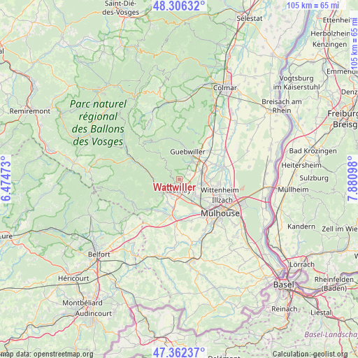
Wattwiller GPS coordinates[2]
47° 50' 11.364" North, 7° 10' 40.26" East
| Map corner | latitude | longitude |
|---|---|---|
| Upper-left | 48.30632°, | 6.47473° |
| Center: | 47.83649°, | 7.17785° |
| Lower-right: | 47.36237°, | 7.88098° |
| Map W x H: | 105×105 km | = 65.2×65.2mi |
| max Lat: | 51.07786° ⇑43.6% North |
| Wattwiller: | 47.83649° |
| min Lat: | ⇓56.4% South 41.3874° |
| min Long | Wattwiller | max Long |
| -5.08615° | 7.17785° | 9.52242° |
| W 95.7%⇐ | ⇒4.3% E |
Elevation
Elevation of Wattwiller is 362 m = 1188 ft, and this is 168.3 m = 552 ft above average elevation for this country.
| Max E: |
2333 m = 7654 ft | 13.8% |
| Wattwiller | 362 m 1188 ft | |
| Avg. | 193.7 m = 635 ft | |
Min E: |
-1 m = -3 ft | 86.2% |
See also: France elevation on elevation.city.
Geographical zone
Wattwiller is located in North temperate zone (between Tropic of Cancer and the Arctic Circle). Distance of this North polar circle is 2082.3 km =1293.9 mi to North.| Distance of | km | miles | from Wattwiller |
|---|---|---|---|
| North Pole | 4688.1 | 2913 | to North |
| Arctic Circle | 2082.3 | 1293.9 | to North |
| Tropic Cancer | 2713 | 1685.8 | to South |
| Equator | 5318.9 | 3305 | to South |


Nearby cities:
15 places around Wattwiller: (largest is in red/bold)
• Aspach-le-Haut
7.5 km =4.7 mi,  207°
207°
• Berrwiller
3.4 km =2.1 mi,  64°
64°
• Bitschwiller-lès-Thann
7.4 km =4.6 mi,  264°
264°
• Bollwiller
6.7 km =4.2 mi,  68°
68°
• Cernay
3 km =1.9 mi,  181°
181°
• Hartmannswiller
4 km =2.5 mi,  45°
45°
• Jungholtz
5.5 km =3.4 mi,  14°
14°
• Soultz-Haut-Rhin
6.9 km =4.3 mi,  33°
33°
• Staffelfelden
5.7 km =3.5 mi,  101°
101°
• Steinbach
2.5 km =1.6 mi,  228°
228°
• Thann
6.4 km =4 mi,  240°
240°
• Uffholtz
1.7 km =1.1 mi, 180°
• Vieux-Thann
5.6 km =3.5 mi, 229°
• Wittelsheim
5.6 km =3.5 mi,  122°
122°
• Wuenheim
4.7 km =2.9 mi, 27°
Sources, notices
• [Note1] Compared only with cities in France existing in our database
• [Src1] Map data: © OpenStreetMap contributors (CC-BY-SA)
• [Src2] Other city data from geonames.org with taken over terms of usage.
• [Src3] Geographical zone / Annual Mean Temperature by Robert A. Rohde @ Wikipedia
