Wittelsheim geodata
Wittelsheim (Grand Est) is a populated place; located in France in Europe/Paris (GMT+2) time zone. With population of 10,220 people, there are 925 cities with bigger population in this country. Compared to other cities in France, 55.9% of cities are located further ↓South; 96.1% of cities are located further ←West and 75.9% of cities have lower elevation than Wittelsheim. Note1
Administrative division(s):
- Level 1: Grand Est
- Level 2: Haut-Rhin
- Level 3: Arrondissement de Mulhouse
- Level 4: Wittelsheim


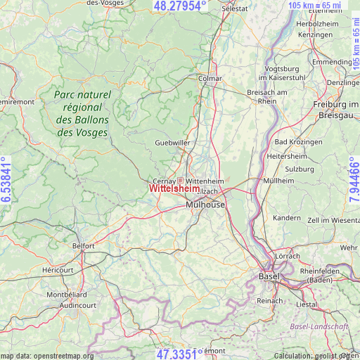
Wittelsheim GPS coordinates[2]
47° 48' 34.092" North, 7° 14' 29.544" East
| Map corner | latitude | longitude |
|---|---|---|
| Upper-left | 48.27954°, | 6.53841° |
| Center: | 47.80947°, | 7.24154° |
| Lower-right: | 47.3351°, | 7.94466° |
| Map W x H: | 105×105 km | = 65.2×65.2mi |
| max Lat: | 51.07786° ⇑44.1% North |
| Wittelsheim: | 47.80947° |
| min Lat: | ⇓55.9% South 41.3874° |
| min Long | Wittelsheim | max Long |
| -5.08615° | 7.24154° | 9.52242° |
| W 96.1%⇐ | ⇒3.9% E |
Elevation
Elevation of Wittelsheim is 256 m = 840 ft, and this is 62.3 m = 204 ft above average elevation for this country.
| Max E: |
2333 m = 7654 ft | 24.1% |
| Wittelsheim | 256 m 840 ft | |
| Avg. | 193.7 m = 635 ft | |
Min E: |
-1 m = -3 ft | 75.9% |
See also: France elevation on elevation.city.
Geographical zone
Wittelsheim is located in North temperate zone (between Tropic of Cancer and the Arctic Circle). Distance of this North polar circle is 2085.3 km =1295.7 mi to North.| Distance of | km | miles | from Wittelsheim |
|---|---|---|---|
| North Pole | 4691.1 | 2914.9 | to North |
| Arctic Circle | 2085.3 | 1295.7 | to North |
| Tropic Cancer | 2710 | 1683.9 | to South |
| Equator | 5315.9 | 3303.1 | to South |


Nearby cities:
15 places around Wittelsheim: (largest is in red/bold)
• Berrwiller
4.8 km =3 mi,  339°
339°
• Bollwiller
5.6 km =3.5 mi,  15°
15°
• Cernay
4.8 km =3 mi,  270°
270°
• Feldkirch
6.6 km =4.1 mi, 21°
• Hartmannswiller
6.1 km =3.8 mi, 341°
• Kingersheim
6.7 km =4.2 mi,  107°
107°
• Lutterbach
6.2 km =3.9 mi,  152°
152°
• Pfastatt
6.4 km =4 mi,  134°
134°
• Pulversheim
5.4 km =3.4 mi,  54°
54°
• Reiningue
6.4 km =4 mi,  185°
185°
• Richwiller
4.4 km =2.7 mi,  138°
138°
• Staffelfelden
2.1 km =1.3 mi, 23°
• Uffholtz
4.9 km =3 mi,  284°
284°
• Wattwiller
5.6 km =3.5 mi,  302°
302°
• Wittenheim
6.4 km =4 mi,  88°
88°
Sources, notices
• [Note1] Compared only with cities in France existing in our database
• [Src1] Map data: © OpenStreetMap contributors (CC-BY-SA)
• [Src2] Other city data from geonames.org with taken over terms of usage.
• [Src3] Geographical zone / Annual Mean Temperature by Robert A. Rohde @ Wikipedia
